চিত্র:WestBengalDistrictscurrent.png
উইকিপিডিয়া, মুক্ত বিশ্বকোষ থেকে

No higher resolution available.
WestBengalDistrictscurrent.png (450 × 500 pixel, file size: ৬৯ KB, MIME type: image/png)
| | এই ফাইলটি উইকিমিডিয়া কমন্স থেকে নেয়া। সেখান থেকে নেয়া ছবিটির বিশদ বর্ণনা নিম্নে প্রদর্শিত হল। |
[edit] Summary
| Description |
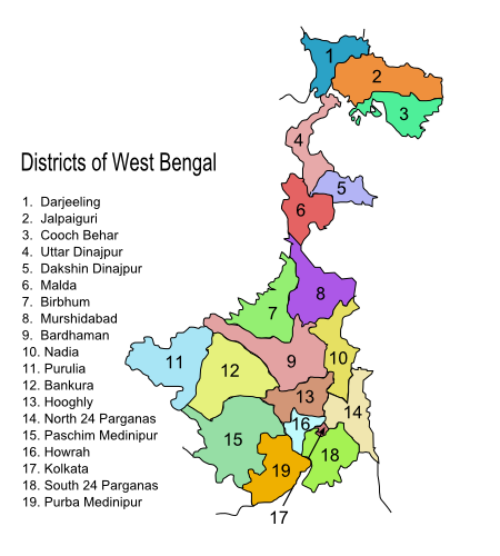
Original summary by creator of base svg file deeptrivia. Districts of West Bengal Based on http://web.archive.org/web/20040606103522/www.censusindia.net/results/2001maps/wbengal01.html Exported from the modified svg file to png. Original modifications can be found here [1], since it was not formatted properly after modifications. Modifications by User:Antorjal:
|
|---|---|
| Source |
http://en.wikipedia.org/wiki/Image:WestBengalDistrictscurrent.png#file |
| Date | |
| Author | |
| Permission |
see below |
[edit] Licensing

সংযোগসমূহ
নিচের পৃষ্ঠা(গুলো) থেকে এই ছবিতে সংযোগ আছে:


![[1]](http://en.wikipedia.org/wiki/Image:WestBengalDistricts_numbered.svg)