Delwedd:Randstad.png
Oddi ar Wicipedia

Maint y rhagolwg: 616 × 599 picsel
Maint llawn (1,053 × 1,024 picsel, maint y ffeil: 528 KB, ffurf MIME: image/png)
[edit] Discription
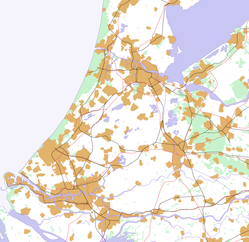
This is a schematic map of the Randstad, Netherlands.
A few notes:
- Orange: Urban areas (schematic) - the urban areas have been a bit overestimated to show the urban areas more clearly. Areas (like parks) in a city are part of the urban area. Some very small villages are not included. Residential areas, industrial and commercial areas are combined.
- Green: Forests and dunes (schematic)- nearby forests and dunes are combined.
- Light Blue: Sea (schematic)
- Middle Blue: Rivers and lakes (schematic) - smaller rivers, lakes and creeks are not included.
- Red: Highways
- Black: Railways
[edit] Licensing
I made this map all by myself in Krita. Last color adjustments where made in the Gimp.

Hanes y ffeil
Cliciwch ar ddyddiad/amser i weld y ffeil fel ag yr oedd bryd hynny.
| Dyddiad/Amser | Defnyddiwr | Hyd a lled | Maint y ffeil | Sylw | |
|---|---|---|---|---|---|
| cyfredol | 17:58, 16 Mawrth 2007 | Samulili | 1,053×1,024 | 528 KB | Reverted. Km scale is a good idea but the image quality (clearness) got worse. |
| 08:38, 27 Chwefror 2007 | Wiki-vr | 1,053×1,024 | 97 KB | with km scale | |
| 15:50, 20 Hydref 2006 | Jeroenvrp | 1,053×1,024 | 528 KB |
Cysylltiadau'r ffeil
Mae'r tudalennau isod yn cysylltu i'r ddelwedd hon:

