Image:Congo-Brazzaville.png
维基百科,自由的百科全书

此为最大尺寸。
Congo-Brazzaville.png (100 × 116 画素, 档案大小: 2 KB, MIME type: image/png)
| Description |
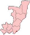
Map of the Republic of the Congo showing Brazzaville commune. Türkçe: Kongo Cumhuriyeti Haritasında Brazavil
|
|---|---|
| Source |
Self-made, traced from public domain UN or CIA maps. |
| Date |
December 2004 |
| Author | |
| Permission |
Provide attribution, please. See below. |
| Other versions | See Image:Congo regions named.png for the map of the regions. |

图像链接
以下页面链接到本图像:

