Image:Aquitaine map.png
From Wikipedia, the free encyclopedia

No higher resolution available.
Aquitaine_map.png (200 × 189 pixel, file size: 29 KB, MIME type: image/png)
| | This is a file from the Wikimedia Commons. The description on its description page there is shown below. |
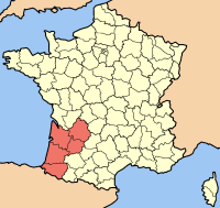
Map of Aquitaine, by Rinaldum.

Permission is granted to copy, distribute and/or modify this document under the terms of the GNU Free Documentation License, Version 1.2 or any later version published by the Free Software Foundation; with no Invariant Sections, no Front-Cover Texts, and no Back-Cover Texts.
Subject to disclaimers.
Map of Aquitaine, by Rinaldum.

File links
The following pages on the English Wikipedia link to this file (pages on other projects are not listed):

