Pilt:Azerbaijan-Ganja.png
Allikas: Vikipeedia

No higher resolution available.
Azerbaijan-Ganja.png (300 × 238 pixel, file size: 12 KB, MIME type: image/png)
| | See on jagatud fail ja asub Wikimedia Commonsis. Faili sealne kirjeldus on toodud allpool.
This is a file from the Wikimedia Commons. The description on its description page there is copied below. |
| Description |
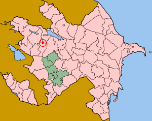
Map of Azerbaijan showing Ganja (Gəncə) sahar. Deutsch: Lage von Gäncä in Aserbaidschan
Esperanto: Situo de Ganĝa en Azerbajĝano
Polski: Miasto wydzielone Gandża
|
|---|---|
| Source |
Self-made, traced from public domain UN or CIA maps, referencing various Azerbaijani sources. |
| Date |
March 2006 |
| Author | |
| Permission |
Provide attribution, please. See below. |
| Other versions | See Image:Azerbaijan districts numbered.png for the numbered map of the rayons. |

Viited pildile
Sellele pildile viitavad järgmised leheküljed:

