Jones Falls Expressway
From Wikipedia, the free encyclopedia
 |
|
| Interstate 83 Main route of the Interstate Highway System |
|
| Jones Falls Expressway | |
| Length: | 10.2 [1] mi (16.32 km) |
|---|---|
| Formed: | 1969 (completed 1990) |
| South end: | Fayette St. in Downtown Baltimore |
| Major junctions: |
|
| North end: | |
|
|
|
The Jones Falls Expressway, known to local residents as the "JFX", is a 10.2-mile (16.32-km) long freeway that carries Interstate 83 from downtown Baltimore to the northern suburbs. It is the area's true north-south artery, because Interstate 95 runs mostly east-west through much of the city. Its southern terminus is at Fayette Street, and its northern terminus is at MD 25, just north of the Baltimore Beltway (I-695).
Contents |
[edit] Route description

The highway begins at an at-grade four-way intersection between the JFX, Fayette St., and President St. The latter roadway continues south along the eastern edge of the CBD to terminate at a traffic circle near the Inner Harbor. Fayette St. serves as an access route into the downtown area.
Passing beneath the Orleans Street Viaduct (part of US 40), the JFX runs north, passing near the Washington Monument. Between Exits 3 and 4, there is a 90-degree turn that sometimes requires motorists to slow down just before entering it. The curve is located between the Guilford Avenue and Preston Street overpasses. This could be considered Baltimore's version of Dead Man's Curve in Cleveland, Ohio, although it is never referred to as such, and the curve is much softer, and easier to handle at normal freeway speed, than its Cleveland counterpart. Within the curve, the southbound JFX interchanges with MD 2.
Having passed this curve, the JFX passes beneath MD 25, then interchanges with US 1 before continuing north past Druid Lake, forming the northeastern boundary of Druid Hill Park. Running northwest out of the city center, the JFX is parallelled by its namesake river, the Jones Falls, on one side, and the Baltimore Light Rail system on the other. Closer to downtown, the light rail line peels off in a different direction, while the Falls flows directly underneath the elevated freeway.
After interchanging with Cold Spring Lane and Northern Parkway (between which, lies the Cylbum Arboretum), the JFX exits Baltimore, entering Baltimore County. Passing close to Mt. Washington Pediatric Hospital, Mt. St. Agnes College, and Jones Falls Park, the route skirts the edge of Robert E. Lee Park before interchanging with Ruxton Road just south of the Baltimore Beltway.
At the Beltway, I-83 leaves the JFX and joins I-695 for a distance of 1.4 miles, where it separates from the latter route to continue onward into northern Maryland. Meanwhile, the JFX continues for another 0.5 miles in a four-lane divided format before terminating at an at-grade intersection with MD 25 Falls Road.
[edit] Future
In 2005, a prominent Baltimore city planner unveiled a proposal to tear down the elevated portion of the JFX that leads into downtown. In the JFX's place, President Street would be extended north to Eager Street, where the elevated section ends. City officials have since offered tentative support for the idea, though it is unlikely that any action will be taken until about 2020, when the current elevated structure will need an overhaul if it is to remain in use. If the downtown JFX were demolished, Baltimore would join San Francisco, Boston and Milwaukee -- all large cities that have removed their downtown elevated freeways.
[edit] History
Due to community opposition to the other freeway plans being produced by city officials, the Jones Falls Expressway was the very first limited-access highway to be completed within the city of Baltimore, and remained so for several years. Originally, the JFX was to continue through the Southeast Baltimore neighborhood of Fells Point to a junction with Interstate 95, but it was met with the same opposition that killed the extension of Interstate 70 into the city.
[edit] Planning
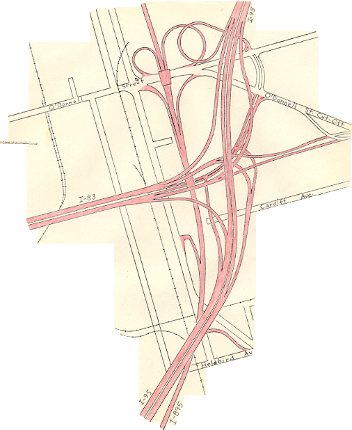
As part of the planning for an east-west route through Baltimore, the alignment of the JFX underwent various modifications. Under the original plan for freeways in Baltimore, the 1962 Baltimore 10-D Interstate System, the JFX would have junctioned I-95, which was planned to follow an east-west route through the southern edge of the CBD, near the southeastern edge of the CBD. [1] As a result of community opposition to other portions of the 10-D System, the 1969 Baltimore 3-A Interstate and Boulevard System was adopted by the city. In this plan, the JFX would continue south along its present alignment, then turn east and pass through the Fells Point neighborhood on a 6-lane elevated viaduct, before continuing east along Boston St. to junction I-95 north of the Fort McHenry Tunnel. In the mid-1970s, this plan was modified due to fears that the viaduct would result in destruction of the Fells Point area, which contains many historic properties. Under the modification, I-83 would continue south and descend into a 6-lane underwater tunnel beneath the Inner Harbor, then turn east under the Harbor, pass to the south of Fells Point, return to the surface in the Little Italy area and continue to I-95. [2]
Under this plan, I-83 was expected to act mostly as a northerly spur to and from the CBD, and as an easterly spur to and from the CBD; through traffic was expected to be a small proportion of the total amount making use of the route. I-83's terminus at I-95 would have been a full 3-way freeway-to-freeway interchange, with a full complement of ramps provided for access to and from Boston St. and O'Donnell St. [3]
[edit] Cancellation

By 1963 the JFX was completed as far as Guilford Avenue, and by the mid-1970s, was extended to Monument Street. By 1983 the route extended all the way to Pleasant St, with a dead-end bridge stub indicating plans to continue south along the 3-A alignment to I-95.
However, in September 1982 the segment of the JFX between Pleasant St. and I-95, a distance of 4.4 miles, was officially withdrawn from the Interstate Highway System. Robert Douglas, chief of the Interstate Division for Baltimore City (IDBC), stated at the time that the very high financial costs of the I-83 extension (estimated at $609 million in early 1980s dollars, and likely to reach $1 billion with inflation taken into account) led to the cancellation of the segment. As a result, the JFX was truncated at Fayette Street, ending at an at-grade intersection. [3]
To make up for the loss of the I-83 segment, the Jones Falls Boulevard project substantially rebuilt approximately 3/4 mile of President St. between I-83 and the downtown area to provide the capacity to absorb traffic to and from the Interstate; the project was completed by 1987. Other roadways in the canceled I-83 corridor also benefited from major reconstruction and rehabilitation. [3] The federal funding planned to be used for the I-83 extension was instead cross-transferred to other highway projects; routes that may have benefited include I-195, I-97 and I-370.
[edit] Notes
An interesting fact is that the JFX does not provide a direct connection to US 40/Orleans Street, which crosses over it on a viaduct. US 40 can be accessed via the side streets of downtown.
[edit] Exit list
This section includes the cancelled part of the JFX that would have connected downtown Baltimore to I-95. Ramp stubs remain at what would have been its junction with I-95, near the Fort McHenry Tunnel.
| County | Municipality | Mile | # | Destinations | Notes |
|---|---|---|---|---|---|
| Baltimore City | Baltimore City | includes access to O'Donnell St./O'Donnell St. Cut-Off | |||
| includes access from O'Donnell St./O'Donnell St. Cut-Off | |||||
| Highland Avenue | |||||
| Baltimore City | Baltimore City | Eastern Avenue | |||
| Baltimore City | Baltimore City | 0.0 | 1 | Fayette Street | currently an at-grade intersection; road continues south as President St.; intersection includes access to Fallsway |
| 0.3 | 2 | Pleasant Street | Southbound only, with northbound entrance from Gay Street | ||
| 0.9 | 3 | Chase Street/Guilford Avenue | Chase Street exit northbound only, with southbound entrance from Eager Street; Guilford Avenue exit southbound only, with northbound entrance from Madison Street | ||
| 1.3 | 4 | Southbound only, with northbound entrance from Charles Street | |||
| 1.5 | 5 | Maryland Avenue | Southbound only, with no entrance in either direction | ||
| 1.9 | 6 | ||||
| 2.4 | 7 | 28th Street/Druid Park Lake Drive | Entrances also available from 29th Street | ||
| 3.0 | 8 | Northbound exit/southbound entrance | |||
| 4.7 | 9 | Cold Spring Lane | |||
| 5.9 | 10 | Northern Parkway | |||
| Baltimore | 9.0 | 12 | Ruxton Road | Northbound exit/southbound entrance | |
| 9.7 | 13 | ||||
| 10.2 | northern end of JFX; road continues as Falls Road | ||||
[edit] See also
[edit] External links
[edit] References
- ^ Kozel, Scott. Roads to the Future: Baltimore Early Expressway Planning URL accessed 11:38, 13 February 2007.
- ^ Kozel, Scott. Roads to the Future: Baltimore City Interstates URL accessed 11:42, 13 February 2007.
- ^ a b c Scale diagram of I-83/I-95 interchange in Baltimore City

