Obrázok:Cyprus districts named.png
Z Wikipédie


No higher resolution available.
Cyprus_districts_named.png (600 × 365 pixel, file size: 22 KB, MIME type: image/png)
Tento súbor je zdieľaný zdroj a môže byť použitý v iných wiki.
| | Toto je súbor z Wikimedia Commons. Prosíme pozrite si jeho popisnú stránku . |
| Description |
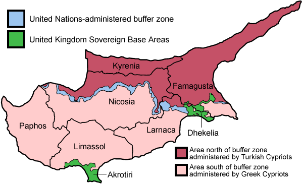
Map of the districts of Cyprus, named in English, with English annotations, and showing the Turkish Republic of Northern Cyprus, United Kingdom Sovereign Base Areas, and United Nations buffer zone. The individual maps are: |
|---|---|
| Source |
Self-made, traced from public domain UN or CIA maps. |
| Date |
June 2005 |
| Author | |
| Permission |
Provide attribution, please. See below. |
| Other versions |
Français :
http://commons.wikimedia.org/wiki/Image:Carte_des_districts_de_Chypre.png |

Odkazy na obrázok
Na tento obrázok odkazujú nasledujúce stránky:

