Bild:Saint martin map.PNG
Wikipedia

Storleken på denna förhandsvisning: 682 × 599 pixlar
Bilden i högre upplösning (1523 × 1338 pixlar, filstorlek: 134 kbyte, MIME-typ: image/png)
| | Denna fil tillhandahålls av Wikimedia Commons. Informationen från filens beskrivningssida följer nedan. |
[edit] Summary
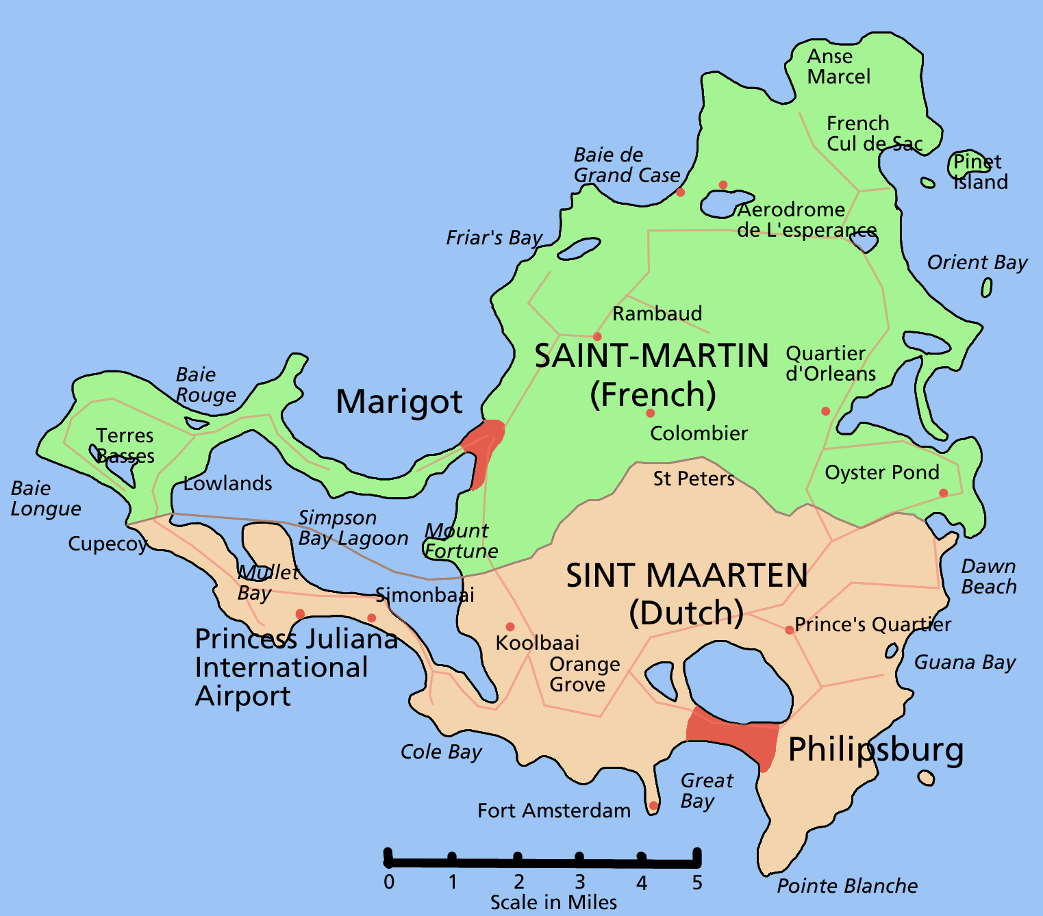
Map of the Caribbean island of w:Saint Martin divided between French and Dutch halves.
 |
This map image should be recreated using vector graphics as an SVG file. This has several advantages; see Commons:Images for cleanup for more information. If an SVG form of this image is already available, please upload it. After uploading an SVG, replace this template with template {{SupersededSVG|new image name.svg}} in this image. |
|
Català | Česky | Dansk | Deutsch | English | Esperanto | Español | Français | Italiano | 日本語 | 한국어 | Nederlands | Polski | Português | Русский | العربية | 正體中文 | +/- |
|
[edit] Licensing

Bildlänkar
Följande sidor länkar till denna bild:

