Imatge:USA Map 1864 including Civil War Divisions.png
De Viquipèdia

No hi ha una versió amb una resolució més gran.
USA_Map_1864_including_Civil_War_Divisions.png (784 × 488 píxels, mida de l'arxiu: 25 KB, tipus MIME: image/png)
| | Aquest arxiu és una càrrega compartida, extreta del projecte Wikimedia Commons i pot ser usada per altres projectes. Si voleu disposar de més informació sobre el fitxer, podeu visitar la pàgina original |
[edit] Description
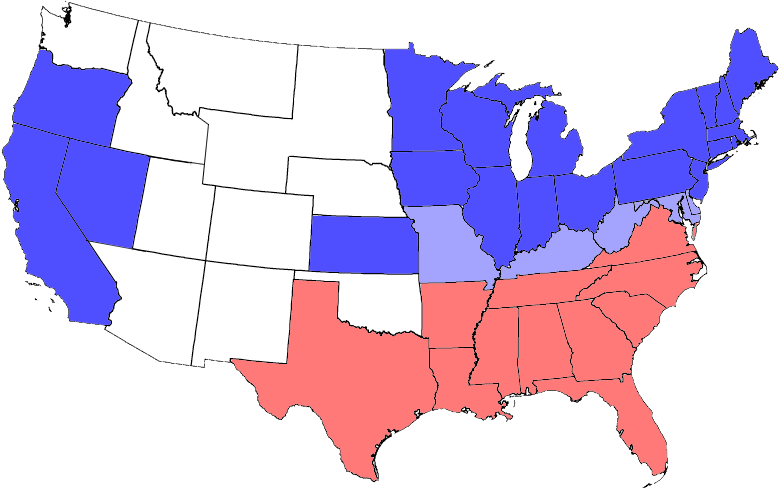
Made using PD map from the Wikimedia Commons and 1864 electoral map from nationalatlas.gov [1]
United States Civil War Division in 1864 - slightly modified from one on Wikipedia. All blue areas represent Union states, including those admitted during the war; light blue areas represent Union states which permitted slavery; red areas represent Confederate states. Unshaded areas were not states before or during the Civil War.
[edit] License

Enllaços a la imatge
Les següents pàgines enllacen a aquesta imatge:

