Kuva:Mount Rainier 7437.JPG
Wikipedia

Esikatselun koko: 800×600 px
Korkeatarkkuuksinen versio (1600×1200 px, 343 KiB, MIME-tyyppi: image/jpeg)
Tämä kuvatiedosto on Wikimedia Commonsista ja se on Wikimedia-projektien yhteiskäytössä. Kuvan sivulla Commons-wikissä on lisätietoja kuvasta ja sen käyttöoikeustiedot.
[edit] Summary
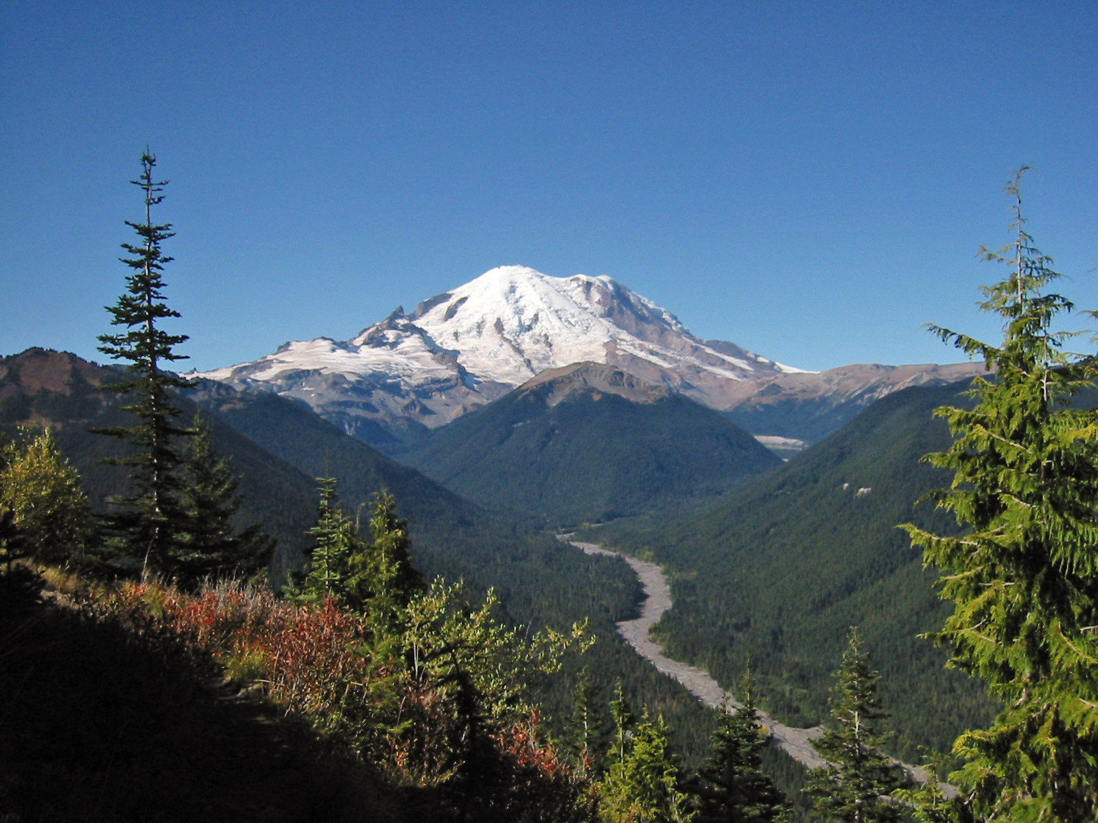
- Description: Mount Rainier with its main summit, Columbia Crest (14410 feet) at the center. Liberty Cap (14112 feet) is to the right behind Russell Cliff. Curtis Ridge descends to the right from Russell Cliff. Massive Emmons Glacier covers most of the visible flank of the mountain. Winthrop Glacier flows right along Curtis Ridge and behind shallow Steamboat Prow (9680 feet) with the small Inter Glacier on its northeast face. Ingraham Glacier (left) is between Gibralter Rock (12660 feet) high on the left skyline and Disappointment Cleaver. Left of Gibralter Rock is sharp pointed Little Tahoma (11138 feet) with Frying Pan Glacier on its flank. It is the source of Frying Pan Creek in the valley left of forested and rounded Goat Island Mountain, in front of the Emmons Glacier. It flows into the White River which comes from the Emmons Glacier and flows around the right side of Goat Island Mountain. In the middle distance, the White River Valley is bounded by Governors Ridge (left) and Sunrise Ridge (right). In the foreground is a Subalpine Fir (left) and a Yellow Cedar (right).
- Viewpoint location: Crystal Peak Trail, Mount Rainier National Park, Washington, USA.
- Lat/Long: 48.7622°N, 121.7580°W (WGS84/NAD83) USGS Mount Baker Quad [1]
- Viewpoint elevation: 5500 feet
- View direction: West-southwest
- Date and time: 2005.09.25 11:35:12 PDT
- Camera: Canon PowerShot S110
- Photographer: Walter Siegmund
©2006 Walter Siegmund
[edit] Licensing
|

Viittaukset sivuilta
Seuraavilta sivuilta on linkki tähän tiedostoon:

