Berkas:Svcmap jamtland.png
Dari Wikipedia Indonesia, ensiklopedia bebas berbahasa Indonesia.


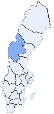
Svcmap_jamtland.png (192 × 400 piksel, ukuran berkas: 8 KB, tipe MIME: image/png)
| | Berkas ini berasal dari Wikimedia Commons. Berikut ini adalah deskripsi berkas dari halaman deskripsi di sana. |
 It is recommended that the other file be used. If you just added this tag and want to nominate this image for deletion, please check if it is used and if so replace it with the new image.
Afterwards please add the following code to here: (Please review the discussion here.)
Important: Before deleting this file, check if the new one is really superior! Also check:
Afrikaans | Alemannisch | العربية | Български | Česky | Dansk | Deutsch | English | Ελληνικά | Esperanto | Español | Français | Galego | עברית | हिन्दी | Magyar | Bahasa Indonesia | Ido | Italiano | 日本語 | 한국어 | Nederlands | Norsk (nynorsk) | Polski | Português | Românǎ | Русский | Slovenščina | Српски | Svenska | Türkçe | 简体中文 | 正體中文 | +/- |
Map Swedish Counties, Jämtlands län
made by: User:Mic
first upload: May 3 2003

Pranala
Halaman-halaman berikut memiliki pranala ke berkas ini:

