Image:Freedom House world map 2005.png
From Wikipedia

Size of this preview: 800 × 370 pixel
Image in higher resolution (1350 × 625 pixel, file size: 58 KB, MIME type: image/png)
[edit] Summary
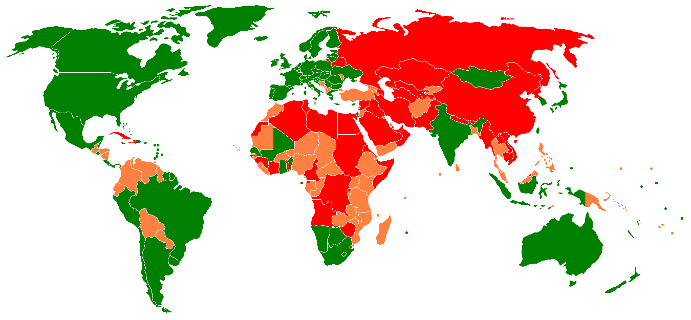
- Description: The Map of Freedom reflects the findings of Freedom House's 2006 survey Freedom in the World (PDF). Freedom in the World is an annual institutional effort that monitors the gains and losses for political rights and civil liberties in 192 nations and 18 related and disputed territories. For each country, the survey provides a concise report on political and human rights developments, along with ratings of political rights and civil liberties. Based on these ratings, countries are divided into three categories: Free (green), Partly Free (orange), and Not Free (red), as reflected in the Map of Freedom.
In Free countries, citizens enjoy a high degree of political and civil freedom. Partly Free countries are characterized by some restrictions on political rights and civil liberties, often in a context of corruption, weak rule of law, ethnic strife, or civil war. In Not Free countries, the political process is tightly controlled and basic freedoms are denied.
- Source: Created by Jebur, based on BlankMap-World.png by Vardion.
- License: GFDL.
[edit] Licensing

Links
The following pages link to this file:

