Bild:Karte Kanton Baselland.png
Us der alemannische Wikipedia, der freie Dialäkt-Enzyklopedy

Größe der Voransicht: 800 × 585 Pixel
Version in höherer Auflösung (1.181 × 863 Pixel, Dateigröße: 176 KB, MIME-Typ: image/png)
| | Des Medium wird direkt vo Wikimedia Commons us ybunde. Aagabe zur Quelle un d'Lizenz cha mer dört uf dr Bildbeschrybigssyte finde. |
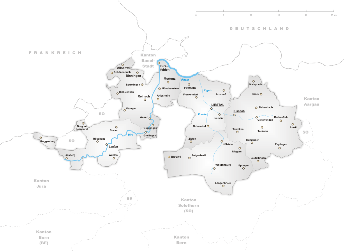
Deutsch: Karte des Kantons Basel-Landschaft.
English: Map of canton Basel-Country.
drawn by/gezeichnet von de:Benutzer:Tschubby 12. Aug 2004

Dateiversionen
Klicke auf einen Zeitpunkt, um diese Version zu laden.
| Version vom | Benutzer | Maße | Dateigröße | Kommentar | |
|---|---|---|---|---|---|
| aktuell | 18:42, 25. Nov. 2006 | Tschubby | 1.181×863 | 176 KB | |
| 17:47, 30. Aug. 2005 | Tschubby | 1.299×949 | 206 KB | ||
| 16:06, 9. Jun. 2005 | Voyager | 1.181×625 | 203 KB | *'''de''': Karte des Kantons Basel-Landschaft. *'''en''': Map of canton Basel-Country. drawn by/gezeichnet von de:Benutzer:Tschubby 12. Aug 2004 {{GFDL}} 1 Baselland |
Bildverweise
Di folgende Sytene händ en Link zu dem Bildli:

