Imachen:Map of NATO countries.png
De Biquipedia

No bi ha garra bersión con mayor resoluzión.
Map_of_NATO_countries.png (742 × 283 píxels; grandaria de l'archivo: 11 KB; tipo MIME: image/png)
| | Iste ye un fichero de Wikimedia Commons, un deposito de contenito libre agüespato por Wikimedia. Más abaxo se reproduze a suya pachina de descrizión con a informazión arredol d'o suyo orichen y lizenzia. |
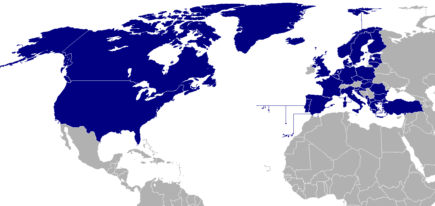
Map of NATO countries, taken from the English Wikipedia.
The image was originally made by User:Donarreiskoffer. This version (corrected regarding Northern Ireland) is identical (except the size) to one uploaded by en:User:Mrowlinson which didn't have a copyright license.

 |
This map image should be recreated using vector graphics as an SVG file. This has several advantages; see Commons:Media for cleanup for more information. If an SVG form of this image is already available, please upload it. After uploading an SVG, replace this template with template {{Vector version available|new image name.svg}} in this image. |
|
العربية | Català | Česky | Dansk | Deutsch | English | Esperanto | Español | Français | 한국어 | Italiano | Magyar | Nederlands | 日本語 | Polski | Português | Română | Русский | Suomi | Svenska | Türkçe | Українська | Tiếng việt | 正體中文 | 简体中文 | +/- |
|
Istorial de l'archibo
Punche en una calendata/ora ta beyer l'archibo como amanixeba por ixas engüeltas.
| Calendata/Ora | Usuario | Dimensions | Grandaria d'o fichero | Comentario | |
|---|---|---|---|---|---|
| autual | 07:31 18 chl 2007 | Hoshie | 742×283 | 11 KB | re-did gray; Bermuda, and Crown Dependencies aren't in UK. Under Same lic. as orginal. |
| 03:00 4 mar 2007 | Aivazovsky | 742×283 | 10 KB | ||
| 23:33 26 fre 2007 | Aivazovsky | 742×283 | 10 KB | ||
| 20:37 13 abi 2006 | Hoshie | 741×289 | 15 KB | Put the surrounding nations in a darker grey so boundries can be seen. Under same license as original. | |
| 20:38 25 chl 2006 | Kseferovic | 741×289 | 15 KB | This is an updated version of the map. Montenegro and Serbia are divided. | |
| 16:54 30 mar 2006 | Valentinian | 741×289 | 13 KB | Updated to include Corsica | |
| 22:31 18 otu 2005 | Valentinian | 741×289 | 14 KB | Updated to include Northern Ireland. This is identical (except the size) to a picture made by en:User:Mrowlinson (en:Image:Map_of_NATO_countries-u.png) but that image didn't have a copyright license, so I uploaded this in its place. The image was original | |
| 11:27 23 set 2005 | E Pluribus Anthony | 741×289 | 10 KB | North Atlantic Treaty Organisation (NATO), members (2005) | |
| 22:17 13 abi 2004 | Ævar Arnfjörð Bjarmason | 758×266 | 15 KB | Map of NATO countries, taken from the english wikipedia. {{GFDL}} en:Image:Nato map.png is:Mynd:Aðildarríki Atlantshafsbandalagsins.png |
Binclos ta la imachen
Istas son as pachinas que tienen binclos ta ista imachen:

