صورة:Satellite image of Spain in January 2003.jpg
من ويكيبيديا، الموسوعة الحرة

حجم هذا العرض: 714 × 600 بكسل
الصورة بدقة كاملة (4,175 × 3,508 بكسل، حجم الملف: 2.42 ميجابايت، نوع الملف: image/jpeg)
|
|
هذا الملف موجود في ويكيميديا كومنز، ويمكن استخدامه في مشاريع ويكيميديا الأخرى. لرؤية هذا الملف في ويكيميديا كومنز اتبع هذه الوصلة. |
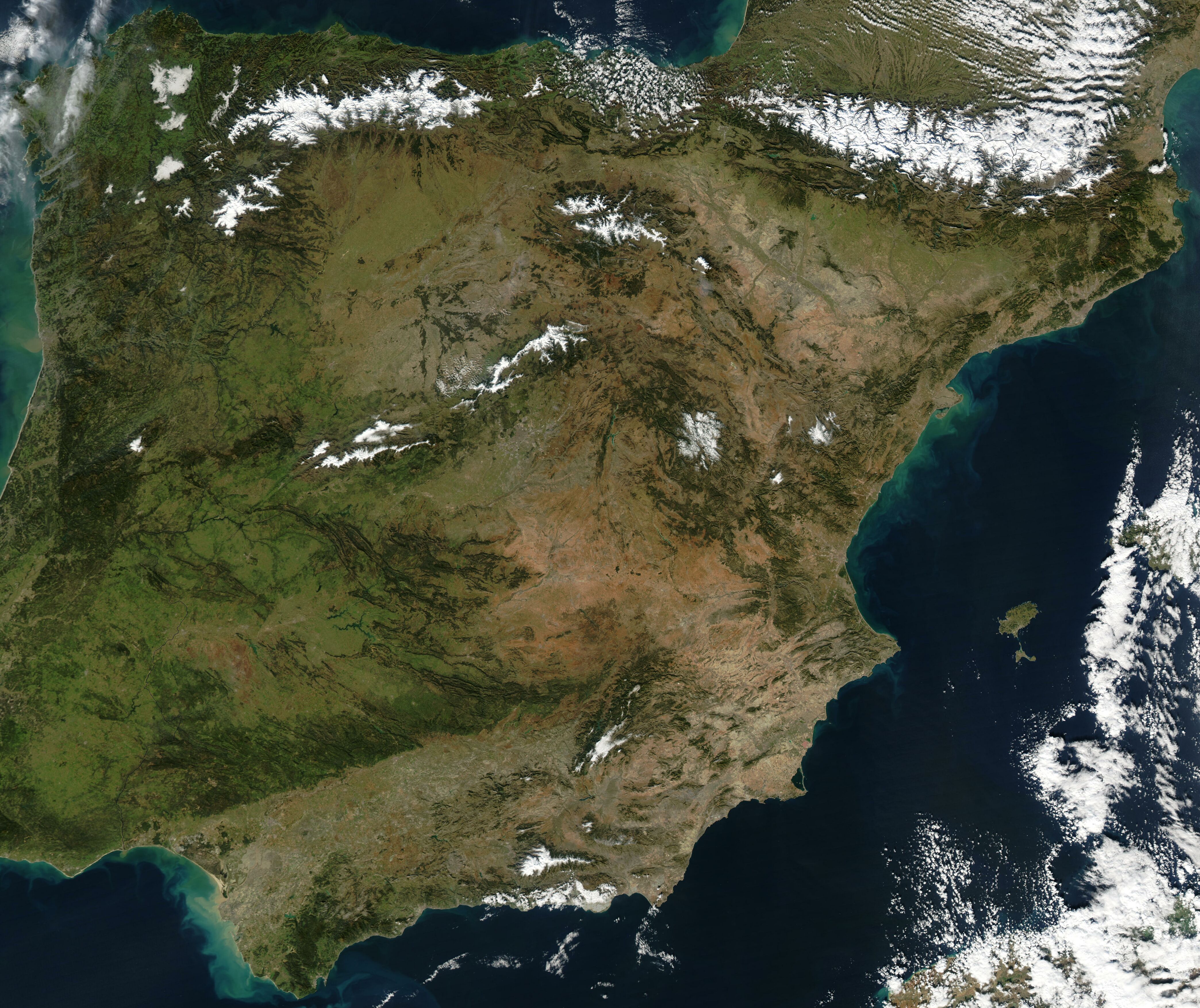
Satellite image of Spain in January 2003. Slightly cropped image, original taken from NASA's Visible Earth http://visibleearth.nasa.gov/cgi-bin/viewrecord?24848 .
- NASA's description: The Iberian Peninsula, home to the countries of Spain and Portugal, stretches toward North Africa in this true-color Aqua MODIS image from January 24, 2003. Portugal sits on the Atlantic side of the peninsula, while Spain takes up the rest and shares a border with France to the northeast. At the bottom of the peninsula is a narrow gap between Europe and North Africa. This gap is the Strait of Gibraltar, which also serves as the buffer between the Atlantic Ocean and the Mediterranean Sea. The northern point of Morocco occupies the other side of the Strait, and farther to the east is northern Algeria.
|
|
This file is in the public domain because it was created by NASA. NASA copyright policy states that "NASA material is not protected by copyright unless noted". (NASA copyright policy page or JPL Image Use Policy).
Languages: Deutsch | English | Español | Français | Nederlands | Português | 简体中文 | 繁體中文 | ... |
|
 |
Warnings:
|
تاريخ الملف
اضغط إحدى وصلات تاريخ/وقت لترى الملف كما كان في هذا الوقت.
| تاريخ/وقت | مستخدم | الأبعاد | حجم الملف | تعليق | |
|---|---|---|---|---|---|
| حالية | 12:54، 20 ديسمبر 2004 | Hautala | 4,175×3,508 | 2.42 ميجابايت | {{PD-USGov-NASA}} Satellite image of Spain in January 2003. Slightly cropped image, original taken from NASA's Visible Earth http://visibleearth.nasa.gov/cgi-bin/viewrecord?24848 . Description: The Iberian Peninsula, home to the countries of Spain and Por |
وصلات
الصفحات التالية تحتوي على وصلة لهذه الصورة:

