صورة:Sulawesi map.PNG
من ويكيبيديا، الموسوعة الحرة

حجم هذا العرض: 543 × 599 بكسل
الصورة بدقة كاملة (1,492 × 1,647 بكسل، حجم الملف: 83 كيلوبايت، نوع الملف: image/png)
|
|
هذا الملف موجود في ويكيميديا كومنز، ويمكن استخدامه في مشاريع ويكيميديا الأخرى. لرؤية هذا الملف في ويكيميديا كومنز اتبع هذه الوصلة. |
[edit] Summary
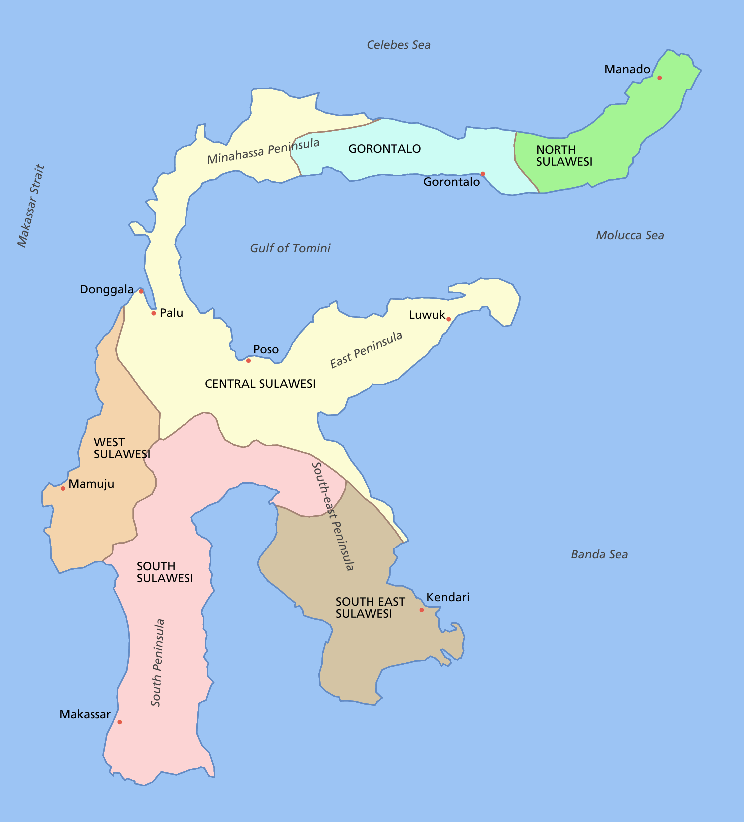
Sulawesi showing provinces, their capital cities, a few other cities and some surrounding areas of water. Note that there are other islands in this area which are not shown as this is a map of Sulawesi island itself.
For a blank map see Image:Sulawesi blank.PNG
[edit] Licensing

تاريخ الملف
اضغط إحدى وصلات تاريخ/وقت لترى الملف كما كان في هذا الوقت.
| تاريخ/وقت | مستخدم | الأبعاد | حجم الملف | تعليق | |
|---|---|---|---|---|---|
| حالية | 12:11، 11 مارس 2006 | Astrokey44 | 1,492×1,647 | 83 كيلوبايت | fixed borders of provinces |
| 04:55، 11 مارس 2006 | Astrokey44 | 1,492×1,647 | 82 كيلوبايت | Sulawesi showing provinces, their capital cities, a few other cities and some surrounding areas of water. Note that there are other islands in this area which are not shown as this is a map of Sulawesi island itself. Category:Sulawesi [[Category:Maps |
وصلات
الصفحات التالية تحتوي على وصلة لهذه الصورة:

