Image:LocationAU.png
From Wikipedia

Size of this preview: 800 × 407 pixels
Full resolution (2,759 × 1,404 pixel, file size: 50 KB, MIME type: image/png)
[edit] Summary
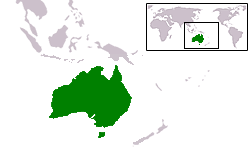
Country locator map for Australia
Uploaded by en:User:E Pluribus Anthony; originally created for the English Wikipedia by en:User:Vardion
 A vector version of this image ("SVG") is available. For more information about vector graphics, read about Commons transition to SVG. Deutsch | English | Español | Français | Galego | עברית | Magyar | Italiano | 日本語 | Polski | Русский | Српски | Українська | +/- |
 |
[edit] Licensing
| I, the copyright holder of this work, hereby release it into the public domain. This applies worldwide. In case this is not legally possible: Afrikaans | Alemannisch | Aragonés | العربية | Asturianu | Български | Català | Česky | Cymraeg | Dansk | Deutsch | Ελληνικά | English | Español | Esperanto | Euskara | فارسی | Français | Galego | 한국어 | हिन्दी | Hrvatski | Ido | Bahasa Indonesia | Íslenska | Italiano | עברית | Kurdî / كوردي | Latina | Lietuvių | Magyar | Bahasa Melayu | Nederlands | Norsk (bokmål) | Norsk (nynorsk) | 日本語 | Polski | Português | Ripoarish | Română | Русский | Shqip | Slovenčina | Slovenščina | Српски | Svenska | ไทย | Türkçe | Українська | Tiếng Việt | Walon | 简体中文 | 繁體中文 | 粵語 | +/- |
File history
Click on a date/time to view the file as it appeared at that time.
| Date/Time | User | Dimensions | File size | Comment | |
|---|---|---|---|---|---|
| current | 16:22, 5 ܬܫܪܝܢ ܩܕܝܡ 2006 | Urhixidur | 2,759×1,404 | 50 KB | Higher resolution version, including territories (Ashmore and Cartier, Christmas, Cocos (Keeling), Heard and MacDonald islands) |
| 15:08, 1 ܐܕܪ 2006 | Drat | 250×115 | 10 KB | Optimised with OptiPNG. | |
| 08:41, 29 ܟܢܘܢ ܬܪܝܢܐ 2006 | E Pluribus Anthony | 250×115 | 13 KB | Country locator map for Australia |
Links
The following pages link to this file:

