Bild:LocationSouthGeorgiaAndSouthSandwichIslands.png
Aus Wikipedia

Keine höhere Auflösung vorhanden.
LocationSouthGeorgiaAndSouthSandwichIslands.png (250 × 115 Pixel, Dateigröße: 5 KB, MIME-Typ: image/png)
| | De Datei wiad ausm zentraln, measprchign Dateiarchiv Wikimedia Commons eibundn. D Quelen- und Lizenzangabn stamman vo da Original-Bschreibungsseitn vo da Datei. | |
[edit] Summary
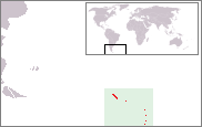
Location map of South Georgia and the South Sandwich Islands. Created by nl:User:Bemoeial based on GFDL-map of en:User:Vardion of Image:LocationFalklandIslands.png.
[edit] Licensing

Dateiversionen
Klicke auf einen Zeitpunkt, um diese Version zu laden.
| Version vom | Benutzer | Maße | Dateigröße | Kommentar | |
|---|---|---|---|---|---|
| aktuell | 12:00, 26. Sep. 2005 | Bemoeial2 | 250×115 | 5 KB | Location map of South Georgia and the South Sandwich Islands. Created by ;nl:Gebruiker:Bemoeial based on GFDL-map of en:User:Vardion of Image:LocationFalklandIslands.png. |
Verwendung
De Seitn benutzen de Datei:

