Afbeelding:Ph physical map.png
Van Wikipedia

Grootte van dit voorbeeld: 382 × 598 pixels
Afbeelding in hogere resolutie (600 × 940 pixels, bestandsgrootte: 114 KB, MIME-type: image/png)
| | Dit is een bestand van Wikimedia Commons. Onderstaande beschrijving komt van de beschrijving van het bestand daar. Controleer het gebruik van dit bestand in andere Wikimediaprojecten. |
 |
This image should be recreated using vector graphics as an SVG file. This has several advantages; see Commons:Images for cleanup for more information. If an SVG form of this image is already available, please upload it. After uploading an SVG, replace this template with template {{SupersededSVG|new image name.svg}} in this image. |
|
Català | Česky | Dansk | Deutsch | English | Esperanto | Español | Français | Italiano | 日本語 | 한국어 | Nederlands | Polski | Português | Русский | العربية | 正體中文 | +/- |
|
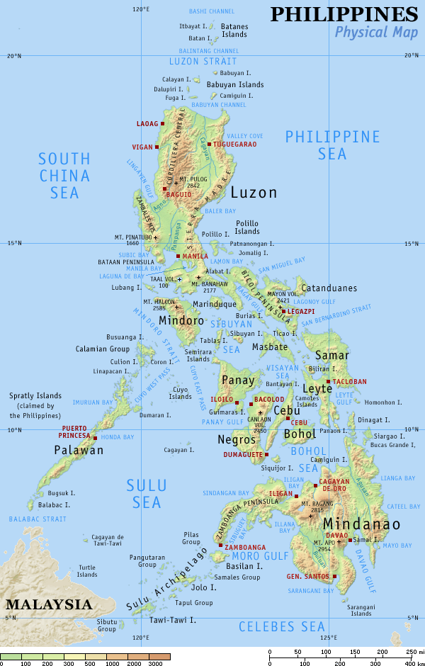
Physical map of the Philippines, showing all the major and some minor islands, bodies of water, mountains, and some major cities.
See blank version which can be used for other language Wikipedias. See also the small version.
Created and copyright (2003) by seav. Released under the GNU FDL.
Source: English Wikipedia, original upload see file history

[edit] File history English Wikipedia
(del) (cur) 15:09, 29 August 2005 . . Riumplus (117068 bytes) (Removed unused colours in the PNG palette, losslessly shrinking file size by 4%)
(del) (rev) 09:09, 25 July 2004 . . Guanaco (121976 bytes) (optimize)
(del) (rev) 08:46, 17 August 2003 . . Seav (122906 bytes) (Updated map with more details)
(del) (rev) 11:13, 20 June 2003 . . Seav (130670 bytes) (Physical map of the Philippines.)
Bestandsverwijzingen
Dit bestand wordt op de volgende pagina's gebruikt:

