Grafika:Donau-Karte.png
Z Wikipedii

Rozmiar podglądu: 800 × 352 pikseli
Obraz w wyższej rozdzielczości (1024 × 451 pikseli, rozmiar pliku: 65 KB, typ MIME: image/png)
| | Plik Donau-Karte.png [ edytuj opis ] umieszczony jest w Wikimedia Commons, repozytorium wolnych zasobów projektów Fundacji Wikimedia. Wyjaśnienie podanej poniżej licencji znajdziesz na stronie Opisy licencji grafiki. |
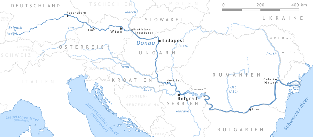
Map of the Danube
- The Map shows the european river Danube
- "drawn" by myself, Daniel Ullrich (Threedots) with Adobe Photoshop 6.0 in February 2005
- If you ask for, I will give you the .psd- / .xfc-file or I'll correct it or create another language version
Karte der Donau
- Die Karte zeigt den europäischen Fluss Donau
- von mir selbst, Daniel Ullrich (Threedots) im Februar 2005 mit Adobe Photoshop 6.0 "gezeichnet"
- Auf Anfrage stelle ich gern die .psd- / .xfc-Datei bereit oder erstelle selbst korrigierte oder andersprachige Versionen

Odnośniki do pliku
Następujące strony odwołują się do tego pliku:

