Изображение:Swissmap.png
Материал из Википедии — свободной энциклопедии

Размер при предпросмотре: 800 × 527 пикселов
Изображение в высоком разрешении (972 × 640 пикселов, размер файла: 456 КБ, MIME-тип: image/png)
| | Cведения об этом файле находятся на Викискладе, — хранилище изображений и мультимедиа для использования в проектах фонда Викимедиа. | |
From en:Image:Swissmap.png, mostly by en:User:Kokiri
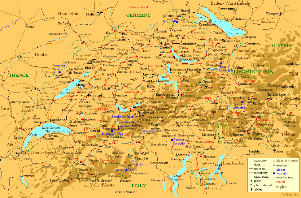
- Description: A map of Switzerland showing places in Switzerland (red) and the neighbouring areas (grey), large lakes (blue) , main rivers (blue), main railways (black), motorways (orange) and places of interest (brown).
- Source: Drawn myself.
New in version 2:
- rivers and lakes now light blue with dark blue labels
- 10 largest cities in bold
- national capitals underlined
- added two motorways around Lake Neuchâtel
- fixed a few inconsistencies and connection points
- removed the 'Battle' out of two historic battle sites
- rendered at a smaller scale for a smaller size
New in version 3:
- corrected spelling of Baden-Württemberg and Vorarlberg
- changed Schwarzwald into a region
- fixed a few inconsistencies
- moved a few names for better readability
New in version 4:
- corrected name of city at lake constance to constance (was Koblenz which is definitely wrong) (User:Andlaus)
New in version 5:
- added a basic relief showing mountains
- fixed some spelling mistakes
- cropped from larger version: Image:SwissmapFull.png, which is also available.

File history
Legend: (cur) = this is the current file, (del) = delete this old version, (rev) = revert to this old version. Click on date to download the file or see the image uploaded on that date. (del) (cur) 05:46, 11 June 2005 . . Kokiri (Talk | contribs) . . 972×640 (466,707 bytes) (New Version) (del) (rev) 04:02, 2 August 2004 . . Andlaus (Talk | contribs) . . 1167×767 (234,757 bytes) (corrected map of switzerland (koblenz->constance)) (del) (rev) 14:06, 17 April 2004 . . Kokiri (Talk | contribs) . . 1167×767 (165,508 bytes) (New verision of the large Swiss Map.) (del) (rev) 05:01, 31 March 2004 . . Kokiri (Talk | contribs) . . 1172×765 (168,489 bytes) (del) (rev) 22:30, 29 March 2004 . . Kokiri (Talk | contribs) . . 1560×1038 (252,608 bytes) (A Map of Switzerland, drawn myself.)
Ссылки
Следующие страницы ссылаются на данный файл:

