Bild:Bulgaria-SanStefano -(1878)-byTodorBozhinov.png
Wikipedia

Storleken på denna förhandsvisning: 769 × 600 pixlar
Bilden i högre upplösning (786 × 613 pixlar, filstorlek: 236 kbyte, MIME-typ: image/png)
| | Denna fil tillhandahålls av Wikimedia Commons. Informationen från filens beskrivningssida följer nedan. |
 |
This image (or all images in this category) uses inside labels or attached captions in a specific script or language and might be converted to a language neutral form. This would allow its use in all Wikimedia projects and, more importantly, all Wikimedia languages.
Deutsch | English | Español | Italiano | 日本語 | Português | Slovenčina | +/- |
 |
This map image should be recreated using vector graphics as an SVG file. This has several advantages; see Commons:Images for cleanup for more information. If an SVG form of this image is already available, please upload it. After uploading an SVG, replace this template with template {{SupersededSVG|new image name.svg}} in this image. |
|
Català | Česky | Dansk | Deutsch | English | Esperanto | Español | Français | Italiano | 日本語 | 한국어 | Nederlands | Polski | Português | Русский | العربية | 正體中文 | +/- |
|
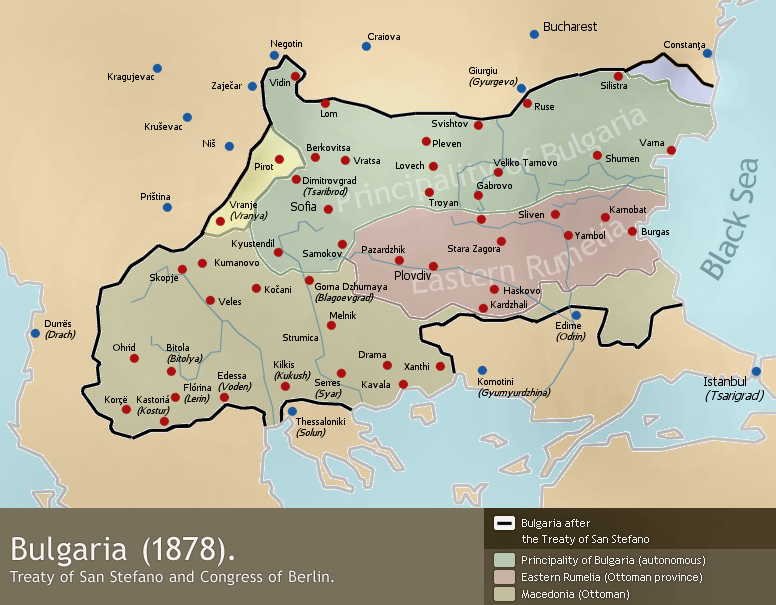
A map of liberated Bulgaria (1878) - borders after the Treaty of San Stefano (3 March 1878) and the Congress of Berlin (June 1878).
Drawn by Todor Bozhinov (me) and released under GFDL.
[edit] Licensing

Bildlänkar
Följande sidor länkar till denna bild:

