Image:Southern Philippines operations 1945.jpg
From Wikipedia, the free encyclopedia

No higher resolution available.
Southern_Philippines_operations_1945.jpg (256 × 180 pixel, file size: 21 KB, MIME type: image/jpeg)
[edit] Summary
http://www.ibiblio.org/hyperwar/USA/USA-C-SPhilippines/maps/USA-C-SPhil-3.jpg
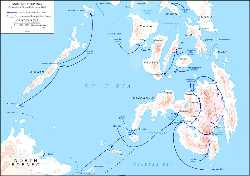
Map of U.S. operations in Southern Philippines, 1945.
[edit] Licensing
| This work is in the public domain in the United States because it is a work of the United States Federal Government under the terms of 17 U.S.C. § 105. See Copyright.
Note: This only applies to works of the Federal Government and not to the work of any individual US state, territory, commonwealth, county, subdivision, or municipality. |
 |
File history
Legend: (cur) = this is the current file, (del) = delete
this old version, (rev) = revert to this old version.
Click on date to download the file or see the image uploaded on that date.
- (del) (cur) 06:04, 22 August 2006 . . Celebrity historian (Talk | contribs) . . 256×180 (21,665 bytes) (Map of U.S. operations in Southern Philippines, 1945.)
- Edit this file using an external application
See the setup instructions for more information.
File links
The following pages on the English Wikipedia link to this file (pages on other projects are not listed):

