Vancouver Island
From Wikipedia, the free encyclopedia
- This page is for the island-region of the Canadian province of British Columbia named Vancouver Island. For the historical Canadian federal electoral region by that name, please see Vancouver Island (electoral districts). For the historical crown colony, see Colony of Vancouver Island


Vancouver Island is located off Canada's Pacific coast and is part of the Canadian province of British Columbia. The island is 460 km (285 miles) long and up to 80 km (50 miles) wide. The largest island on the western side of the Americas at 32,134 square kilometres (12,407 square miles), it is the world's 42nd largest island, Canada's 11th largest island and Canada's second highest populated island. The island is named in honour of George Vancouver, the British Royal Navy officer who explored the Pacific northwest coast between 1791 and 1794.
The 2001 census population was 656,312. As of 2005, Vancouver Island had an estimated population of 723,000. Slightly less than half of these (326,000) live in Greater Victoria. Other major cities on Vancouver Island include Nanaimo, Port Alberni, Parksville, Courtenay, and Campbell River.
Contents |
[edit] Geography
Vancouver Island is roughly divided between a rugged, wet west coast and a drier, more rolling east coast by the Vancouver Island Ranges, which run down most of the length of the island. The highest point in these ranges and on the island is the Golden Hinde, at 2195 m or 7200'. Located near the centre of Vancouver Island in the 250,000 ha or 620,000 acre Strathcona Provincial Park, it is part of a group of peaks that include the only glaciers on the island, the largest of which is the Comox Glacier. The west coast shoreline is rugged, and in many places mountainous, characterised by its many fjords, bays, and inlets. The interior of the island has many lakes (Kennedy Lake, northeast of Ucluelet, is the largest) and rivers. Vancouver Island formed when volcanic and sedimentary rock scraped off the ancient Kula Plate and plastered against the continental margin when it was subducting under North America 55 million years ago.
The rain shadow effect of the island's mountains, as well as the mountains of Washington's Olympic Peninsula, creates wide variation in precipitation. The west coast is considerably wetter than the east coast. Average annual precipitation ranges from 6,650 millimetres or some 260 in at Henderson Lake on the west coast (making it the wettest spot in North America) to only 635 millimetres or 25 in at the driest recording station in the provincial capital of Victoria on the southeast coast's Saanich Peninsula. Precipitation is heaviest in the autumn and winter. Temperatures are fairly consistent along both coasts, however; winters are mild, and summers are cool to moderately warm, depending on location. The yearly average temperature hovers around 10°C (50°F). Snow is rare at low altitudes but is common on the island's mountaintops in winter.
Vancouver Island lies in the temperate rainforest biome. On the southern and eastern portions of the island, this is characterized by Douglas-fir, western red cedar, arbutus, Garry oak, salal, Oregon-grape, and manzanita. This is the heavily populated region of Vancouver Island, and a major area for recreation. The northern, western, and most of the central portions of the island are home to the coniferous "big trees" associated with British Columbia's coast — hemlock, western red cedar, amabilis fir, yellow cedar, Douglas-fir, grand fir, Sitka spruce, and western white pine. It is also characterised by broadleaf maple, red alder, sword fern, and red huckleberry.
The fauna of Vancouver Island is similar to that found on the mainland coast, with some notable exceptions and additions. For example, grizzly bear, porcupine, moose, skunk, and coyote, while plentiful on the mainland, are absent from Vancouver Island. The island does contain Canada's only population of Roosevelt elk, however, and one species — the Vancouver Island Marmot — is endemic to the region. The island's rivers, lakes, and coastal regions are renowned for their fisheries of trout, salmon, and steelhead. It has the most concentrated population of cougars in North America.
[edit] History
[edit] Native Settlement
The island has been inhabited by humans for some eight thousand years[citation needed]. By the late 1700s, the primary First Nations there were the Nuu-chah-nulth (Nootka) on the west coast, various nations of the Salish language group on the south and east coasts, and the Kwakiutl on the centre and north of the island. The National Maps show a nation of Vancouver consisting of the island and the mainland coastal regions from Queen Charlotte Sound to Cape Flattery.
[edit] European Exploration
Europeans began to encroach on the island in 1774, when rumours of Russian fur traders caused the Spanish to send a ship, the Santiago north under the command of Juan José Pérez Hernández. In 1775 a second Spanish expedition, under Juan Francisco de la Bodega y Quadra, was sent. Neither actually landed.
Vancouver Island came to the attention of the wider world after the third voyage of Captain James Cook, who landed at Nootka Sound of the Island's western shore on March 31, 1778 and claimed it for the United Kingdom. The island's rich fur trading potential led the British East India Company to set up a single-building trading post in the native village of Yuquot on Nootka Island, a small island in the Sound.
The island was further explored by Spain in 1789 by Esteban José Martínez, who built Fort San Miguel on one of Vancouver Island's small offshore islets in the sound near Yuquot. This was to be the only Spanish settlement in what would later be Canada. The Spanish began seizing British ships and the two nations came close to war, but the issues were resolved peacefully with the Nootka Convention in 1792, in which both countries recognized the other's rights to the area. Supervising the British activities was Captain George Vancouver from King's Lynn in England, who had sailed as a midshipman with Cook, and from whom the island gained its name.
[edit] British settlement

The first British settlement on the island was a Hudson's Bay Company post, Fort Camosun, founded in 1843, and later renamed Fort Victoria. Shortly thereafter, in 1846, the Oregon Treaty was signed by the British and Americans to settle the question of the Oregon Territory borders. It awarded all of Vancouver Island to the British, despite a portion of the island lying south of the 49th parallel. In 1848, the Colony of Vancouver Island was established. Following the brief governorship of Richard Blanshard, James Douglas, Chief Factor of the Hudson's Bay post, assumed the role in 1851 — a position he would maintain for the next thirteen years.
Fort Victoria became an important base during the Fraser Canyon Gold Rush in 1858, and the burgeoning town was incorporated as Victoria in 1862. Victoria became the capital of the colony of Vancouver Island, then retained that status when the island was amalgamated with the mainland in 1866. A British naval base was established at Esquimalt, British Columbia in 1865, and eventually taken over by the Canadian military.
The economic situation of the colony declined following the Cariboo Gold Rush of 1861-62, and pressure grew for amalgamation of the colony with the mainland colony of British Columbia (which had been established in 1858). The colony's third and last governor, Sir Arthur Kennedy oversaw the union of the two colonies in 1866.
[edit] Economy
Vancouver Island's economy outside Victoria is largely dominated by the forestry industry, with tourism and fishing also playing a large role. Many of the logging operations are for paper pulp, in "2nd growth" tree farms that are harvested approximately every 30 years. In recent years the government of British Columbia has engaged in an advertising program to draw more tourists to beach resorts such as Tofino.
Logging operations involving old-growth forests such as those found on Clayoquot Sound are controversial, and have gained international attention through the efforts of activists and environmental organizations.
There are rapidly expanding vineyards and the island produces wines that outscored some French wines at the St. Catharines Wine Tasting of 2005 in blind evaluations.
Between Vancouver Island and the Canadian mainland there are several high voltage power cables (HVDC Vancouver-Island).
There is also a rather fast building IT field on Vancouver Island. High Speed Internet is delivered to the island from Shaw, TELUS, CRTV and CRCN. There are also many information sites such as: VancouverIslandLive.com and Vancouver Island Travel. Wireless Internet connections can be found all over the island, many free for public use. Most coffee shops allow free laptop use and charge an average of five cents a minute for using their computers.
Higher education plays an economic role in the Greater Victoria area being as both students and staff of the many post secondary schools number well over 50,000. The University of Victoria is the largest school on the island enrolling 19,475 students in 2006/2007 and employing 4,124 staff. Royal Roads University is much smaller with 2,268 students and 680 staff. Camosun College is also located on a few campuses across the Greater Victoria region and has 17,000 students and almost 1,000 staff (though close to half of the students are under the distance education umbrella). Malaspina University-College is Vancouver Island's other main university with its main campus in Nanaimo, as well as other campuses in Duncan, Parksville and Powell River. Malaspina represents a unique combination of a degree-granting university and a practical college. There are also numerous community colleges and international education centres.
[edit] Transportation
[edit] Marine transportation
Marine transportation is very important to Vancouver Island for access to the mainland of British Columbia and Washington. There are no bridges connecting the island to the mainland, although the idea of building one has been brought up many times. The only vehicle access to Vancouver Island is via ferries operated by BC Ferries, Washington State Ferry and Black Ball Transport Inc. There are six vehicle ferry routes:

- Tsawwassen BC (38 km south of Vancouver) - Swartz Bay BC (32 km or 20 mi north of Victoria)
- Crossing time: 1 hour 35 minutes; 8 sailings per day in the fall, winter, and spring and more in summer
- Tsawwassen BC - Duke Point BC (13 km or 8 mi south of Nanaimo)
- Crossing time: 2 hours; 8 round trips daily
- Horseshoe Bay BC (20 km or 12 mi northwest of Vancouver) - Departure Bay BC (3 km or 2 mi north of Nanaimo)
- Crossing time: 1 hour 35 minutes; Sailings every 2 hours with extra sailings during the summer and holidays
- Powell River BC - Comox BC
- Crossing time: 1 hour 20 minutes; 4 round trips daily
- Anacortes WA - Sidney BC
- Crossing time: 3 hours (not counting stops in the San Juan Islands)
Black Ball Transport
- Port Angeles WA - Victoria BC
- Crossing time: 1 hour 30 minutes; 1 or 2 round trips daily
In addition, there are three passenger-only ferry services from the mainland to Vancouver Island:
Victoria Clipper
- Seattle WA - Victoria BC
- Crossing time: 2 hour 45 minutes; 1 to 3 round trips daily
Victoria Express
- Port Angeles WA - Victoria BC (operates May through September)
- Crossing time: 1 hour
Victoria San Juan Cruises
- Bellingham WA - Victoria BC (operates one trip per day May through October)
- Crossing time: 3 hours
[edit] Rail transportation
There are two remaining major railways on Vancouver Island.
The Southern Railway of Vancouver Island, which assumed control of the Esquimalt and Nanaimo Railway from RailAmerica in July of 2006 offers general freight service on the Victoria-Courtenay main line (called the Victoria Subdivision by the railroad). The Port Alberni branch line (called the Port Alberni Subdivision by the railroad) has been out of service since late 2001. SVI also runs passenger service under contract with VIA Rail Canada.
Western Forest Products operates Canada's last logging railway out of Woss, BC to Beaver Cove on the northern end of the island.
The Former Canadian National railway out of Victoria to the Cowichan Valley was abandoned in the late 1980s/early 1990s and the former grade between Victoria and Sooke, and Shawnigan lake and Lake Cowichan is now a multi-use trail.
The BC Forest Museum has a narrow gauge railway winding around the park, and the Alberni Pacific Railway operates during the summer from the restored E&N Railway station in Port Alberni to the McLean's Mill on former E&N Railway trackage.
[edit] Road transportation
Vancouver Island is one of the few places in North America where double-deck buses are used in the regular public transit system. They are part of the Greater Victoria bus service.
As Victoria, the capital and Island's largest city, continues to grow, traffic will also be a concern. The notorious rush-hour "Colwood Crawl" has not been alleviated by efforts to improve road transit between Victoria and the Western Communities, and with the development of new housing and business such as the Bear Mountain golf resort, the bottleneck in traffic is sure to be a concern for years to come.
Proposals have been made for a "fixed link" to the mainland for over a century. Due to the extreme depth of the Georgia Strait and potential seismic activity, a bridge or tunnel would face monumental engineering, safety, and enviromental challenges at a colossal cost (see link below).
[edit] Air transportation
There are two major airports on Vancouver Island. Victoria International Airport is the smaller of the two, but handles the majority of the air traffic on Vancouver Island. Five major carriers (Air Canada, Air Canada Jazz, Horizon Air, Pacific Coastal, and Westjet) offer a variety of flights of short and medium distance including to and from Seattle, Calgary, Vancouver, Toronto and Montreal.
CFB Comox is the larger of the major airports, but handles fewer civilian flights due to AIRCOM comprising most of the traffic. It serves many of the same cities as Victoria's airport but also includes more small coastal communities.
There are numerous smaller airports on Vancouver Island mostly flying Pacific Coastal, Westjet, Central Mountain Air, and Air Canada Jazz. These are at Port Hardy, Campbell River, Courtenay (private), Nanaimo, and Port Alberni (charter only). All can be flown to on a weekly basis through one of the major carriers.
[edit] See also
- First Nations on Vancouver Island
- Canadian wine
- Cascadia subduction zone
- Cougar Annie
- Kinsol Trestle
- Vancouver Island Health Authority
[edit] External links
- CFDCS* Tofino Time Magazine
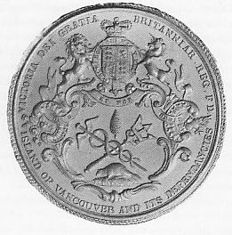
- Great Seal of the crown colony of Vancouver Island
- CBC News: Vancouver Island moves west
- Measuring crustal motions in coastal British Columbia with continuous GPS
- BC Ministry of Transportation - Report on Fixed Link
Ahousat • Bamberton • Bamfield • Black Creek • Bowser • Brentwood Bay • Buckley Bay • Campbell River • Cassidy • Cedar • Central Saanich • Chemainus • Clo-oose • Coal Harbour • Cobble Hill • Colwood • Comox • Coombs • Courtenay • Cowichan Bay • Cowichan Station • Crofton • Cumberland • Deep Bay • Duncan • Errington • Esquimalt • Fanny Bay • French Creek • Genoa Bay • Gold River • Harewood • Highlands • Holberg • Honeymoon Bay • Kildonan • Koksilah • Ladysmith • Lake Cowichan • Langford • Lantzville • Malahat • Maple Bay • Merville • Mesachie Lake • Metchosin • Mill Bay • Nanaimo • Nanoose Bay • Nitinat • North Cowichan • North Saanich • Oak Bay • Oceanside • Oyster River • Parksville • Port Alberni • Port Alice • Port Hardy • Port McNeill • Port Renfrew • Qualicum Beach • Quatsino • River Jordan • Royston • Saanich • Saanichton • Saltair • Sayward • Shawnigan Lake • Sidney • Sooke • Tahsis • Telegraph Cove • Tofino • Ucluelet • Union Bay • Greater Victoria • Victoria • View Royal • Westholme • Winter Harbour • Woss • Youbou • Yuquot (Friendly Cove) • Zeballos

