Imagen:ArmeniaNumbered.png
De Wikipedia, la enciclopedia libre

Dimensiones de esta vista previa: 594 × 600 píxeles
Ver la imagen en su resolución original (750 × 757 píxeles; tamaño de archivo: 81 KB; tipo MIME: image/png)
| | Éste es un fichero de Wikimedia Commons, un depósito de contenido libre hospedado por la Fundación Wikimedia. Más abajo se reproduce su página de descripción con la información sobre su origen y licencia. |
  It is recommended that the other file be used. If you just added this tag and want to nominate this image for deletion, please check if it is used and if so replace it with the new image.
Afterwards please add the following code to here: (Please review the discussion here.)
Important: Before deleting this file, check if the new one is really superior! Also check:
Afrikaans | Alemannisch | العربية | Български | Česky | Dansk | Deutsch | English | Ελληνικά | Esperanto | Español | Français | Galego | עברית | हिन्दी | Magyar | Bahasa Indonesia | Ido | Italiano | 日本語 | 한국어 | Nederlands | Norsk (nynorsk) | Polski | Português | Românǎ | Русский | Slovenščina | Српски | Svenska | Türkçe | 简体中文 | 正體中文 | +/- |
[edit] Summary
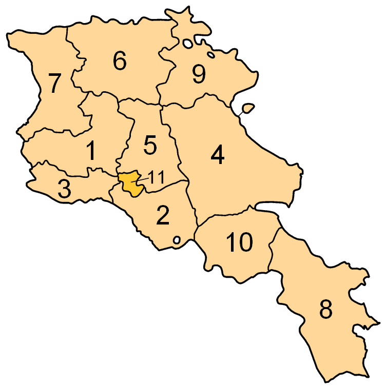
Subdivisions of Armenia. Map created by w:en:user:Golbez. Coloured by w:en:user:Aivazovsky.
[edit] Licensing

Image shows the eleven administrative subdivisions of Armenia:
- Aragatsotn (Արագածոտնի)
- Ararat (Արարատի)
- Armavir (Արմավիրի)
- Gegharkunik (Գեղարքունիքի)
- Kotayk (Կոտայքի)
- Lori (Լոռու)
- Shirak (Շիրակի)
- Syunik (Սյունիքի)
- Tavush (Տավուշի)
- Vayots Dzor (Վայոց Ձորի)
- Yerevan (Երևան) - special administrative status
Enlaces a la imagen
Las siguientes páginas enlazan a esta imagen:

