Kuva:Randstad.png
Wikipedia

Esikatselun koko: 616×599 px
Korkeatarkkuuksinen versio (1053×1024 px, 528 KiB, MIME-tyyppi: image/png)
Tämä kuvatiedosto on Wikimedia Commonsista ja se on Wikimedia-projektien yhteiskäytössä. Kuvan sivulla Commons-wikissä on lisätietoja kuvasta ja sen käyttöoikeustiedot.
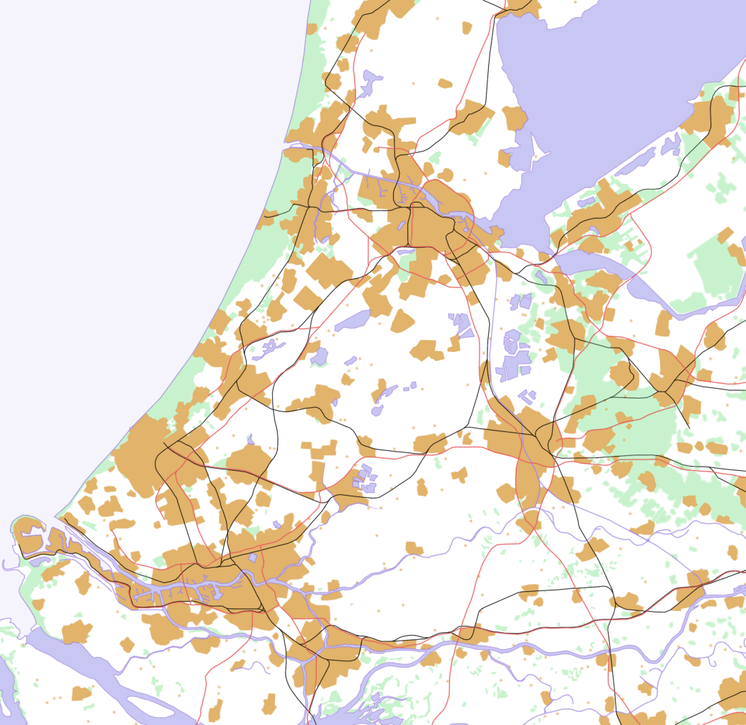
[edit] Discription
This is a schematic map of the Randstad, Netherlands.
A few notes:
- Orange: Urban areas (schematic) - the urban areas have been a bit overestimated to show the urban areas more clearly. Areas (like parks) in a city are part of the urban area. Some very small villages are not included. Residential areas, industrial and commercial areas are combined.
- Green: Forests and dunes (schematic)- nearby forests and dunes are combined.
- Light Blue: Sea (schematic)
- Middle Blue: Rivers and lakes (schematic) - smaller rivers, lakes and creeks are not included.
- Red: Highways
- Black: Railways
[edit] Licensing
I made this map all by myself in Krita. Last color adjustments where made in the Gimp.

Viittaukset sivuilta
Seuraavilta sivuilta on linkki tähän tiedostoon:

