Kép:ZIP code zones.png
A Wikipédiából, a szabad lexikonból.

Az előnézet mérete: 800 × 564 képpont
A kép nagyfelbontású változata (976 × 688 képpont, fájlméret: 182 KB, MIME-típus: image/png)
| Description |
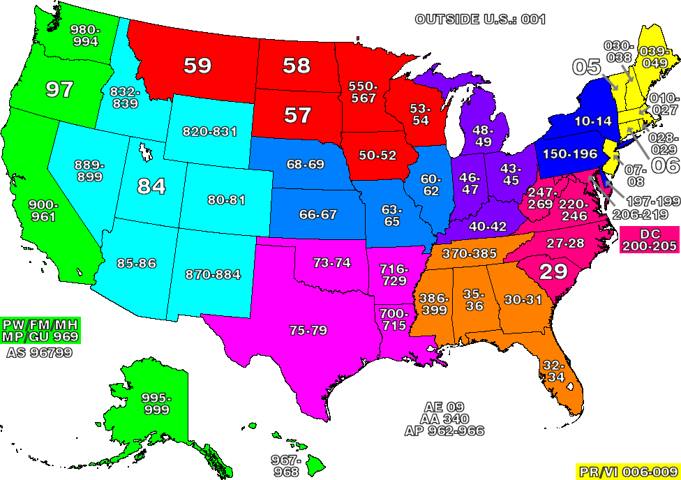
This map of the United States divides the country into ZIP code zones. All states with a common colour use ZIP codes starting with the same digit. Where only two digits are used, the allocation reflects all existing ZIP codes starting with those two digits. Nederlands: ZIP code gebieden in de Verenigde Staten
中文 : 圖示美國各州的郵區編號,字頭相同的州份會以相同顏色表示。
|
|---|---|
| Source |
own work |
| Date | |
| Author |
denelson83 |
| Permission |
GNU-FDL |

Képhivatkozások
Az alábbi lapok hivatkoznak erre a képre:

