그림:Thailand provinces.png
위키백과 ― 우리 모두의 백과사전.

No higher resolution available.
Thailand_provinces.png (268 × 450 pixel, file size: 28 KB, MIME type: image/png)
![]() 이 자료는 위키미디어 공용에 있습니다. 이 자료에 대한 설명이 아래에 있습니다.
이 자료는 위키미디어 공용에 있습니다. 이 자료에 대한 설명이 아래에 있습니다.
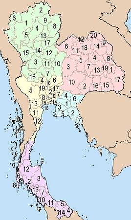
Map of Thailand showing the provinces numbered. Numbering is done according to alphabetic sorting of the standard english transscription of the province name, done for each of the five regions separately.
|
North
|
North-East (Isaan)
|
|
Central
|
East
South
|

| This file is licensed under Creative Commons Attribution ShareAlike 1.0 License |
그림 링크
다음 문서들이 이 그림을 사용하고 있습니다:

