Imago:US Roman Catholic dioceses map.png
E Vicipaedia

Size of this preview: 800 × 520 pixel
Image in higher resolution (1513 × 983 pixel, file size: 29 chiliocteti, MIME type: image/png)
| | Hic est fasciculus ex Vicimediis Communibus. Vide eius descriptionem apud Communia ut plura discas. |
[edit] Summary
| Description |
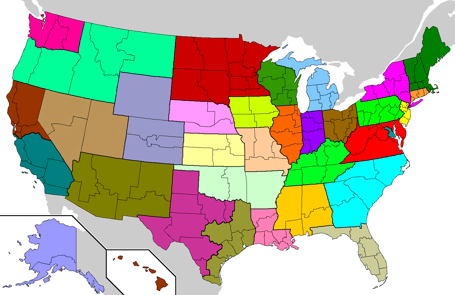
Geographical Latin rite Roman Catholic dioceses of the United States. Each of the 32 ecclesiastical provinces is a separate color. Eastern rite eparchies and dioceses are not shown. |
|---|---|
| Source |
based on en:Image:Dioceses.GIF by John Kenney |
| Date | |
| Author | |
| Permission |
GDFL, same as original |
| Other versions | en:Image:Dioceses.GIF (older image but with same current data) |
Based on en:Image:Dioceses.GIF by John Kenney, which was based on U.S. county maps already on Wikipedia. Changes by Closeapple using The Gimp: made water bodies transparent; removed dithering on Canada and Mexico; gave each of the 32 provinces a unique color; colored Isle Royale in Michigan, islands in northwestern Washington state, and minor islands in Alaska, California, Florida, North Carolina, and Texas; removed some spurs left over from erased county lines.
Image characteristics: PNG format, 8-bit palette, 34 unique colors + 1 transparent entry (1 for each province; grey for Canada/Mexico; transparent for water). Recompressed with PNGOUT with 12288-byte blocks.
[edit] Licensing
Modifications released by Closeapple under the same GDFL terms as the original work by John Kenney. John Kenney source: "created myself, based on map of US counties already on wikipedia".

Nexus
Paginae sequentes ad hunc fasciculum nectunt:

