Image:Peleliu map.jpg
From Wikipedia, the free encyclopedia

Size of this preview: 366 × 599 pixel
Image in higher resolution (850 × 1392 pixel, file size: 505 KB, MIME type: image/jpeg)
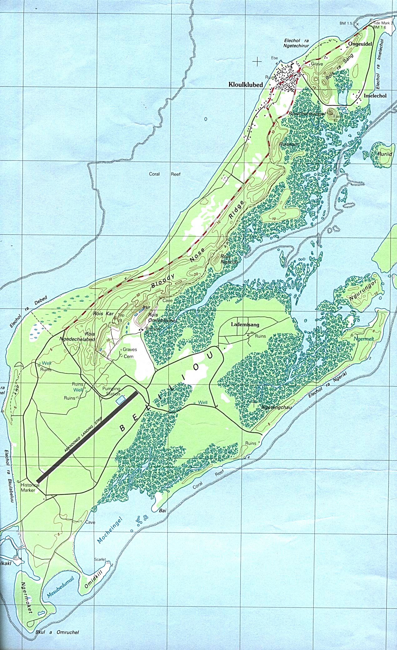
Map of Peleliu Island
from Perry-Castañeda Library Map Collection
|
|
File history
Legend: (cur) = this is the current file, (del) = delete
this old version, (rev) = revert to this old version.
Click on date to download the file or see the image uploaded on that date.
- (del) (cur) 21:37, 7 March 2005 . . Darwinek (Talk | contribs) . . 850×1392 (517,270 bytes)
- Edit this file using an external application
See the setup instructions for more information.
File links
The following pages on the English Wikipedia link to this file (pages on other projects are not listed):
Metadata
This file contains additional information, probably added from the digital camera or scanner used to create or digitize it. If the file has been modified from its original state, some details may not fully reflect the modified image.
| Orientation | Normal |
|---|---|
| Horizontal resolution | 72 dpi |
| Vertical resolution | 72 dpi |
| Y and C positioning | 1 |
| Exif version | 2 |
| Color space | sRGB |

