Imagem:Cameroon boundary changes.PNG
Origem: Wikipédia, a enciclopédia livre.

Tamanho desta previsão: 448 × 600 pixel
Imagem numa resolução maior (508 × 680 pixel, tamanho do ficheiro: 18 KB, tipo MIME: image/png)
[edit] Summary
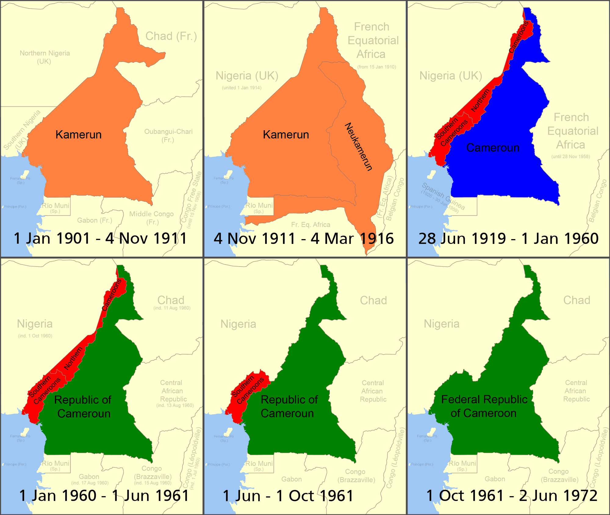
Boundary changes in w:Cameroon.
- Orange = German colony of Kamerun (given more territory by the French in 1911 following the w:Agadir Crisis)
- Red = British w:Cameroons after WWI (divided into separate Northern Cameroons and Southern Cameroons - Northern Cameroons consisted of two non-contiguous sections; the top red segment shown here and part of the bottom one)
- Blue = French Cameroun after WWI
- Green = Independent Cameroon ("Northern Cameroons" and the northern part of "Southern Cameroons" has become part of Nigeria; southern part of "Southern Cameroons" joined with the independent country of cameroon in 1961). made using Image:BlankMap-World.png
- See also map at external site
[edit] Licensing

Ligações
As seguintes páginas apontam para este ficheiro:

