Image:Roman Empire Map.png
From Wikipedia, the free encyclopedia

No higher resolution available.
Roman_Empire_Map.png (800 × 548 pixel, file size: 69 KB, MIME type: image/png)
| | This is a file from the Wikimedia Commons. The description on its description page there is shown below. |
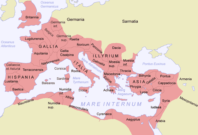
From time to time, the Roman Empire also stretched to the Persian Gulf and around the Black Sea areas, Including Armenia and Mesopotamia.

File links
The following pages on the English Wikipedia link to this file (pages on other projects are not listed):

