Slika:Rome carthage 218.jpg
Iz Wikipedije, proste enciklopedije


Velikost predogleda: 800 × 594 točk
Slika v višji resoluciji (1108 × 822 točk, velikost datoteke: 190 KB, MIME-vrsta: image/jpeg)
| | Datoteka je del Wikimedijine zbirke. Najverjetneje so vsi navedeni podatki s tamkajšnje opisne strani. |
[edit] Summary
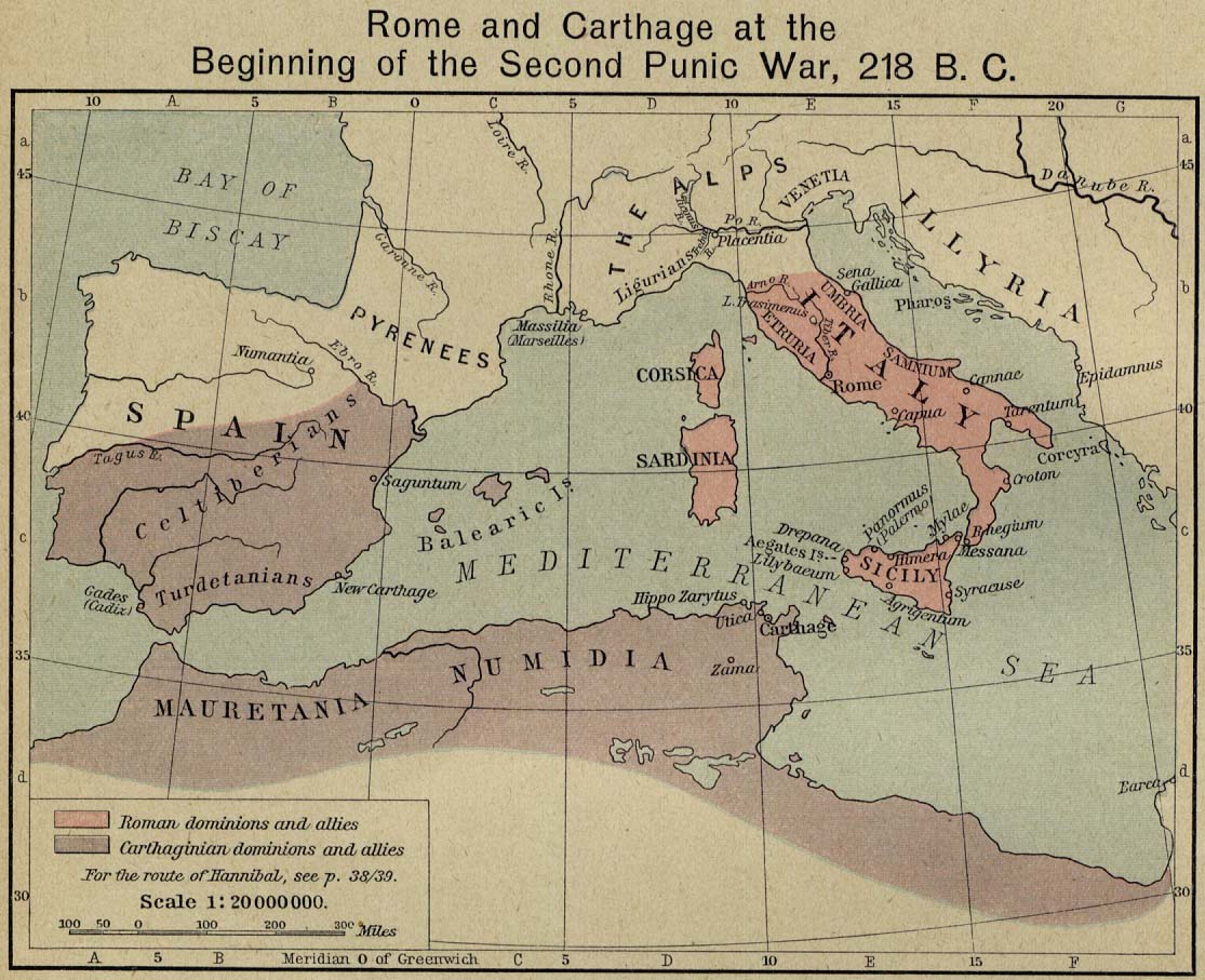
Rome and Carthage at the Beginning of the Second Punic War, 218 B.C.
Scan from "Historical Atlas" by William R. Shepherd, New York, Henry Holt and Company, 1923.
Original image at the Perry-Castañeda Library Map Collection at the University of Texas at Austin website: http://www.lib.utexas.edu/maps/historical/shepherd/rome_carthage_218.jpg
Some cropping of the file to remove wide white borders and large font caption.
From the FAQ @ http://www.lib.utexas.edu/maps/faq.html
- Most of the maps scanned by the University of Texas Libraries and served from this web site are in the public domain. No permissions are needed to copy them. You may download them and use them as you wish.
- A few maps are copyrighted, and are clearly marked as such. Any that are copyrighted by The University of Texas are subject to our Materials Usage Guidelines.
This map is not so marked.
[edit] Licensing
|
|
This image is in the public domain in the United States. In most cases, this means that its first publication was in the United States prior to January 1, 1923 or that its copyright expired in the United States. |
|
|
|
This image might not be in the public domain outside of the United States (this especially applies in Canada, China (not Macao or Taiwan), Germany or Switzerland). The creator and year of publication are essential information and must be provided. See Wikipedia:Public domain and Wikipedia:Copyrights for more details. |
Strani z datoteko
Datoteka je del naslednjih strani slovenske Wikipedije (strani drugih projektov niso navedene):
Metapodatki
Datoteka vsebuje še druge podatke, ki jih je verjetno dodal za njeno ustvaritev oziroma digitalizacijo uporabljeni fotografski aparat ali optični bralnik. Če je bila datoteka pozneje spremenjena, podatki sprememb morda ne izražajo popolnoma.
| Vodoravna ločljivost | 200 dpi (točk/palec) |
|---|---|
| Navpična ločljivost | 200 dpi (točk/palec) |

