Bild:Texas Panhandle.PNG
Wikipedia

Det finns ingen högupplöst version tillgänglig.
Texas_Panhandle.PNG (300 × 284 pixlar, filstorlek: 15 kbyte, MIME-typ: image/png)
| | Denna fil tillhandahålls av Wikimedia Commons. Informationen från filens beskrivningssida följer nedan. |
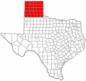
| Description |
Map of Swisher County Texas modified to show entire Panhandle |
|---|---|
| Source |
Originally from en.wikipedia; description page is/was here. |
| Date |
2004-07-31 (original upload date) |
| Author |
Original uploader was H2O at en.wikipedia |
| Permission |
Released under the GNU Free Documentation License. |
[edit] License information

 |
This map image should be recreated using vector graphics as an SVG file. This has several advantages; see Commons:Images for cleanup for more information. If an SVG form of this image is already available, please upload it. After uploading an SVG, replace this template with template {{SupersededSVG|new image name.svg}} in this image. |
|
Català | Česky | Dansk | Deutsch | English | Esperanto | Español | Français | Italiano | 日本語 | 한국어 | Nederlands | Polski | Português | Русский | العربية | 正體中文 | +/- |
|
[edit] Original upload log
(All user names refer to en.wikipedia)
- 2004-07-31 19:32 H2O 300×284×8 (15219 bytes) Map of Swisher County Texas modified to show entire Panhandle
Bildlänkar
Följande sidor länkar till denna bild:

