Image:Cities of Tierra del Fuego.png
维基百科,自由的百科全书

此为最大尺寸。
Cities_of_Tierra_del_Fuego.png (519 × 475 画素, 档案大小: 21 KB, MIME type: image/png)
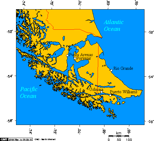
English: Cities of Tierra del Fuego
Esperanto: Urboj de Fuegio
Español: Ciudades de Tierra del Fuego

This map is taken from en:Image:Cities of Tierra del Fuego.png and was created with this online map creation tool. Uploaded by en:User:Geo Swan on 14 March 2005.
The longitude and latitude of the cities follow:
- -70.9333,-53.1666,Punta Arenas
- -70.3648,-53.2959,Porvenir
- -67.6167,-54.9333,Puerto Williams
- -68.2978,-54.7921,Ushuaia
- -67.5982,-53.8114,Rio Grande
图像链接
以下页面链接到本图像:

