Image:Mongols-map.png
维基百科,自由的百科全书

此为最大尺寸。
Mongols-map.png (728 × 525 画素, 档案大小: 279 KB, MIME type: image/png)
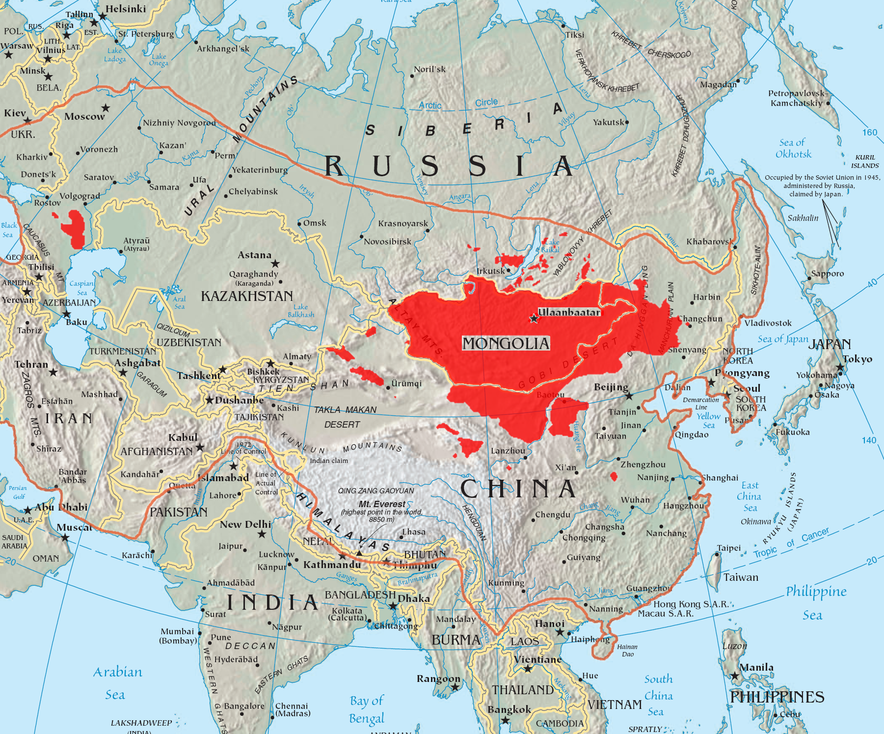
This is a map of the places that Mongol peoples live. The information is based off of w:en:Image:Mongolsethnic.jpg, and the map I started with is w:en:Image:Asia-map.png.
The orange line shows the extent of the Mongol Empire in the late 13th century. The red areas are the places dominated by ethnic Mongols.

| This file is licensed under Creative Commons Attribution ShareAlike 2.0 License. In short: you are free to share and make derivative works of the file under the conditions that you appropriately attribute it, and that you distribute it only under a license identical to this one. |
图像链接
以下页面链接到本图像:

