Tsushima Island
From Wikipedia, the free encyclopedia
| Tsushima Island Native name: 対馬 |
|
|---|---|
| Geography | |
| Location | Tsushima Strait |
| Coordinates | |
| Administration | |
| City | Tsushima, Nagasaki |
Tsushima Island (対馬 Tsushima) is an island in Japan, situated in the Tsushima Strait at 34°25'N and 129°20'E.[1] It is the largest island of the Nagasaki Prefecture. In the past, a separate provincial branch governed the island. In March 2004, all six towns on the island merged to form the city of Tsushima, which encompasses the entire island[2].
Contents |
[edit] Geography
Tsushima Island is located horizontally west of the Kanmon Strait between Honshū and Kyūshū of the Japan's mainland. The Korea Strait splits at the Tsushima Island Archipelago into two channels; the wider channel, also closer to the mainland of Japan, is the Tsushima Strait. Ōfunakoshi-Seto and Manzeki-Seto, the two canals built in 1671 and 1900 respectively, connect the deep indentation of the Aso Bay (浅茅湾) to the east side of the island. The archipelago comprises thirteen smaller islets in addition to the main island.
Tsushima is the closest Japanese territory to the Korean peninsula lying within fifty kilometres from Busan;[citation needed] on a clear day, the hills and mountains of the Korean peninsula are visible from the higher elevations on the two northern mountains. The nearest Japanese port Iki, situated entirely in the Tsushima Basin, is also fifty kilometres away[citation needed]. The Tsushima Island and the Iki Island contain the Iki–Tsushima Quasi-National Park,[2] designated as a nature preserve and protected from further development. 89% of Tsushima is covered by natural vegetation and mountains.[3]
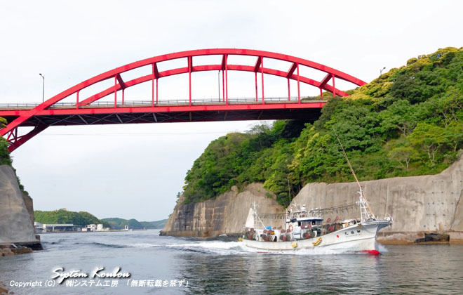
The Japanese government administers the Tsushima Island as a single entity, although it consists of two separate main islands connected by the narrow isthmus outlined by the Aso Bay. The northern area is known as Kamino-shima, and the southern island as Shimono-shima. Both sub-islands have a pair of mountains: Shimono-shima has Mount Yatachi (矢立山), 649 metres (2,130 feet) high,[citation needed] and Shira-dake, 512 metres (1,680 feet) high.[citation needed] Kamino-shima has Ibeshi-yama, 344 metres (1,128 feet)[citation needed] and Mi-take, 487 metres (1,598 feet).[citation needed] The two main sections of the island are now joined by a combination bridge and causeway[4][5]. The island has a total area of 696.26 square kilometres.

[edit] Climate
Tsushima has a marine subtropical climate strongly influenced by the monsoon winds.[citation needed] The average temperature is 15.5°C,[citation needed] and the average yearly precipitation is 2,133 millimetres.[citation needed] The highest temperature ever recorded on the island is 36.0°C, in 1966,[citation needed] and the lowest –8.6°C, in 1895.[citation needed] Mostly throughout the year, Tsushima is 1 ~ 2 °C cooler than the city of Nagasaki.[citation needed] The island's rainfall is generally larger than that of the main islands of Japan, which is attributed to the difference in their size. Because Tsushima is small and isolated, it is exposed on all sides to moist marine air, which releases precipitation as it ascends the island's steep slopes. Continental monsoon winds carry loess (yellow sand) from China in the spring and cool the island in the winter[2]. The rainy season begins and ends later than other areas in Nagasaki Prefecture, and Tsushima rarely suffers direct hits by typhoons.[6]
[edit] Economy
According to a 2000 census, 23.9% of the local population is employed in primary industries, while 19.7% and 56.4% of the population are employed in secondary and tertiary industries, respectively. Of these economic activities, fishing amounts to 82.6% of the primary industry, with much of it dedicated to catching squid on the eastern coast of the island.
However, the number of employees in the primary industries has been decreasing, while employee growth in the secondary and tertiary industries has increased. Tourism, targeting mainly Koreans, has recently made a great contribution to the islands' economy.
[edit] Demographics and culture
The population of the Tsushima Island has been decreasing significantly, as evidenced by the 5.2% decrease between the years of 1995 and 2000.[2] Nuclear families are replacing the traditional extended families, therefore, maintaining the number of households at a smaller population.[2] The elderly population makes up for nearly a quarter of the population, much higher than 20.8% of the Nagasaki Prefecture and the national average of 17.3%.[2] Religious traditions on Tsushima Island mirror those of the rest of Japan, with a majority of the population adhering to Buddhism or Shinto.
| Years | 1975 | 1980 | 1985 | 1990 | 1995 | 2000 |
|---|---|---|---|---|---|---|
| Total Population | 52,472 | 50,810 | 48,875 | 46,064 | 43,513 | 41,230 |
| Age 0-14 | 14,449 | 12,845 | 11,615 | 10,050 | 8,352 | 6,834 |
| Age 15-64 | 33,028 | 32,528 | 31,376 | 29,264 | 27,145 | 25,001 |
| Age 65 & older | 4,995 | 5,437 | 5,884 | 6,735 | 8,016 | 9,395 |
| Households | 14,760 | 15,176 | 15,232 | 15,164 | 15,169 | 15,038 |
[edit] History
[edit] Early history
Archeological evidence suggests that Tsushima was already inhabited by settlers from the Korean peninsula and Japanese archipelago from the Jomon period to the Kofun period. According to the Sanguo Zhi, a Chinese historical text, a thousand families in Tsushima founded the Tsuikai kingdom (対海国).[7] These families exerted control over Iki Island, and established trading links with Yayoi Japan. Since Tsushima had almost no land to cultivate, islanders earned their living by fishing and trading. Japanese mythology states that Tsushima was one of the eight original islands created by the Shinto deities Izanagi and Izanami.
Beginning in the early 6th century, Tsushima was a province of Japan, known as Tsushima Province (対馬国 Tsushima-no-kuni or 対州 Taishū). However, Before the rise of the Joseon Dynasty in Korea, the Koreans periodically considered Tsushima to be Korean territory.[8] Some Korean believe that the ancient Korean kingdom of Silla took Tsushima as a dependency, though it is not known whether actual control was exerted over the island. The discovery of a book written by American missionary Homer Hulbert mentioning Silla's occupation of Tsushima island has been cited by modern Korean historian, Lee Hyun-bok.
Under the Ritsuryo system, Tsushima became a province of Japan. This province was politically and economically linked with Dazaifu, the central city of Kyūshū, as well as the central government of Japan. Due to its strategic location, Tsushima played a major role in defending Japan against invasions from the Asian continent and developing trade lines with Baekje and Silla of Korea. After Japan was defeated by the Chinese, at that time ruled by the Táng Dynasty, at the Battle of hakusukinoe in 663, border guards were sent to Tsushima, and Kaneda Castle was constructed on the island.
Tsushima Province was controlled by the Tsushima no Kuni no miyatsuko (対馬国造) until the Heian Period, and then by the Ahiru clan until the middle of the 13th century. The role and title of "Governor of Tsushima" was exclusively held by the Shoni clan for generations. However, since the Shoni actually resided in Kyūshū, it was the So clan, known subjects of the Shoni, who actually exerted control over these islands. The So clan governed Tsushima until the late 15th century.
Tsushima was an important trade center during this period. After the Toi invasion, private trade started between Goryeo, Tsushima, Iki, and Kyūshū, but halted during the Mongol invasions of Japan between 1274 and 1281. Koryosa, a historian of the Goryeo dynasty, mentions that in 1274, an army of Mongol troops that included many Korean soldiers killed a great number of people on the islands. However, the Mongols were prevented from further aggression against Japan.
Tsushima became one of the major bases of the Wokou, Japanese pirates, also called wakō, along with the Iki and Matsuura. Suffering from repeated invasions, the Goryeos and their successors, the Joseons, placated the pirates by establishing trade agreements, as well as negotiating with the Muromachi shogunate and its deputy in Kyūshū. In 1389, General Park Wi (朴威) of Goryeo attempted to clear the island of Wokou pirates, but uprisings in Korea forced him to return home.
On June 19, 1419, the recently-abdicated Sejong the Great of Joseon ordered his trusted general Yi Jong Mu to clear the island of the Wokou pirates, using a fleet of 227 vessels and 17,000 soldiers.
In 1510, Japanese traders initiated an uprising against Joseon's stricter policies on Japanese traders from Tsushima and Iki coming to Pusan, Ulsan and Jinhae to trade. The So Clan supported the uprising, but it was soon crushed. The uprising was later came to be known as the "Three-Ports incident" (三浦の乱). Trade resumed under the direction of King Jungjong in 1512, but only under strictly limited terms, and only twenty-five ships were allowed to visit Joseon annually. [9]
In the late 16th century, Japanese leader Toyotomi Hideyoshi united the various feudal lords (daimyō) under his command, planning to unite all factions with a common cause. Hideyoshi's coalition invaded Yi Dynasty Korea, in an attack leading to the Seven-Year War. Tsushima was the main naval base for this invasion, and in continuing support of the war, large numbers of Korean laborers were transported to Tsushima until 1603.
After Japan's invasion attempts failed, peace was re-established between the two nations. Once again, the islands became a port for merchants. Both the Joseon Dynasty and the Tokugawa shogunate sent their trading representatives to Tsushima, governing trade until 1755. During the Edo period, Japanese rule was slowly re-established, as the Joseon Dynasty did not intend to colonize the island with its own people, following its policy of leaving islands uninhabited. However, the Joseon government did not recognize the Japanese claim to Tsushima, and continued printing official maps with Tsushima as part of its own territory until 1860.[10] In the late 19th century, the Meiji government officially incorporated the island under Japanese rule.
Because of the Abolition of the han system, the Tsushima Fuchu domain became part of Izuhara Prefecture in 1871. In the same year, Izuhara Prefecture was merged with Imari Prefecture, which was renamed Saga Prefecture in 1872. Tsushima was transferred to Nagasaki Prefecture in 1872, and its districts of Kamiagata (上県) and Shimoagata (下県) were merged to form the modern Tsushima City. This change was part of widespread reforms within Japan, starting after 1854. Japan was at this time becoming a modern nation state and regional power, with widespread changes in government, industry, and education.
[edit] Twentieth century
After the First Sino-Japanese War ended with the Treaty of Shimonoseki, Japan felt humiliated when the Triple Intervention of the three great powers of Germany, France, and Russia forced it to return the valuable Liaodong Peninsula to China under threat of force. Consequently, the Japanese leadership correctly anticipated that a war with Russia or another Western imperial power was eventually likely. Between 1895 and 1904, the Japanese navy blasted the Manzeki-Seto canal twenty-five meters wide and three meters deep, which was later expanded to forty meters wide and four and a half meters deep (Nagasaki prefectural website), through a mountainous rocky isthmus of the island, between Aso Bay to the west and Tsushima Strait to the east, technically dividing the island into three islands (topographical map). Strategic concerns explain the scope and funding of the canal project by Japan during an era when it was still struggling to establish an industrial economy. The canal enabled the Japanese to move transports and warships quickly between their main naval bases in the Inland Sea (directly to the east), via the Kanmon and Tsushima straits, into the Korea Strait, or to destinations beyond in the Yellow Sea.
During the Russo-Japanese War in 1905, the Russian Baltic fleet under Admiral Rozhdestvensky, after making an almost year-long trip to East Asia from the Baltic coast, was crushed by the Japanese under Admiral Togo Heihachiro at the Battle of Tsushima. The Japanese third squadron (cruisers) began shadowing the Russian fleet off the tip of the south island, and followed it through the Tsushima Strait where the main Japanese body waited. The battle began slightly east-northeast of the northern island around midday, and ended to its north a day later when the Japanese surrounded the Russian Fleet. Few battles in history have been so decisive.
During the Korean War, when the Korean People's Army approached the coastal areas of South Korea near Pusan in August 1950, Tsushima acted as a refuge centre for many prominent South Koreans. [1]
In the 60ies one of the transmitters for the OMEGA-navigation system was built on Tsushima.
Today, Tsushima is part of the newly reorganized Nagasaki Prefecture of Japan. On March 1, 2004, the six towns on the island, including Izuhara, Mitsushima, Toyotama, Mine, Kami-agata, and Kami-tsushima, were merged to create Tsushima City.
[edit] Sovereignty claims by Korea
After Oei Invasion in 1419, the ruler of Tsushima,Sadamori surrendered to Korea and made a tribute relationship as a subject. In the 1st leap month of 1420, Sadamori requested to become a state of Korea as Daemado, promised to become a subject and control Wokou by themselves. King Sejong grantted this request and let him report to Kyongsang province not to Seoul directly.[2] As a result, Tsushima could be a trading hub between Japan and Korea during 16C.
After World War II, a movement to claim Tsushima arose in South Korea, citing its historical relations to the various kingdoms of Korea.[3] In 1948, the office of the Political Advisor of the Supreme Commander of the Allied Powers (SCAP) received a document titled "Request for Arrangement of Lands Between Korea and Japan." It was said to come from the "Patriotic Old Men's Association" of Seoul, Korea. The document was a justification of Korea's sovereignty claims over Ulleung-do, Dokdo (Takeshima), and Tsushima islands. Although from a private organization, the document followed the Republic of Korea President Syngman Rhee's thinking regarding disputes with Japan. [4]
In a New Year's press conference in 1949, South Korean President Syngman Rhee formally requested that Japan cede the island to Korean rule. This claim was not accepted by the military government of SCAP under General Douglas MacArthur. Subsequent investigations, both historical and governmental, have shown the difficulty of assessing this claim, as the islands have historical references dating back to the 240s AD showing them in mixed control. With the outbreak of the Korean War the next year, and the economic struggles that South Korea faced in the following decade, South Korea's government ceased to assert territorial claims.
Later, in the 1952 San Francisco Peace Treaty, it was declared that the sovereignty of Tsushima was to be handed to Japan. Despite the fact that the Peace Treaty was signed in 1951, South Korean President Syngman Rhee later declared that Tsushima was part of South Korea in the Peace Line declaration of January 18, 1952.[5]
Provoked by Shimane Prefecture's claim to Dokdo (Takeshima in Japanese), the Korean city of Masan declared June 19 "Daemado day" on March 18, 2005, claiming Tsushima — Daemado (Hangul: 대마도; Hanja: 對馬島) in Korean — as part of South Gyeongsang province of South Korea. [6] The Masan council replied that it would not retract its claim, stating that Tsushima was never formally ceded to Japan. The Japanese government did not make any official response to the city council's claim. The municipal council in Tsushima did make a strong protest to the municipal council of Masan on October 6, 2006, demanding the withdrawal of the ordinance, but Masan rejected the appeal. [7] In addition, the council has also rejected calls by South Korea's Ministry of Foreign Affairs and Trade to withdraw the claim[11].
[edit] Notable people from Tsushima
- Tsuyoshi Shinjo - Baseball player
- MISIA - Japanese singer
[edit] Further reading
- Ian Nish, A Short History of JAPAN, 1968, LoCCC# 68-16796, Fredrick A. Praeger, Inc., New York, 238 pp.
-
- British Title and Publisher: The Story of Japan, 1968, Farber and Farber, Ltd.
- Edwin O Reischauer, Japan - The Story of a Nation, 1970, LoCCC# 77-10895 Afred A. Knopf, Inc., New York. 345 pp. plus index.
[edit] See also
- History of Japan
- Korean-Japanese disputes (Anti-Japanese sentiment)
- So clan
- Tsushima Fuchu domain
- Tsushima Province
- Tsushima subprefecture
- OMEGA Transmitter Shushi-Wan
[edit] References
- ^ MaqQuest on Tsushima Island's coordinates.
- ^ a b c d e f g Info on Tsushima Shi
- ^ Asahi.com article on Tsushima
- ^ Aerial view of the junction between the two islands of Tsushima Island
- ^ Water level view of the junction between the two islands of Tsushima Island
- ^ BBC article on typhoons
- ^ zhulang.com
- ^ donga.com
- ^ dictionary.goo.ne.jp
- ^ Wikimedia Commons category on Historical maps of Korea
- ^ "Masan Rejects Call to Drop Claim on Tsushima", The Korea Times, 20-03-2005. Retrieved on 06-02-2007.
[edit] External links
[edit] Japanese-based infosites
- A Profile of Tsushima City
- Open minds bridge the gap between cultures - Cho Kyung-dal
- 15th century Korean artifact unearthed on Tsushima Island, published by Japan Science Scan
- Reaching across the strait 1/ Sleepy Tsushima discovered in a big way
- (Japanese) A list of annual events and matsuri's in Tsushima
[edit] Korean-based infosites
- A 1998 newsgroup posting by Gari Ledyard, King Sejong Professor of Korean History at Columbia University in the City of New York
- Canadian blogspot in response to Korean ultranationalists
- Korea Times: Tsushima Controlled by Ancient Korean Kingdom
- Blogspot: The American Problem
- English-language Korean blogspot of Tsushima
- Tsushima Island for Korea?, blog mirror [8]
- U.S. State Department, Report from the Office of Intelligence Research: Korea´s Recent Claim to the Island of Tsushima (prepared on March 30, 1950)
- "Request for Arrangement of Lands Between Korea and Japan," by the Patriotic Old Men´s Association, Seoul, Korea (August 5, 1948).
[edit] Other infosites
[edit] News
- Japan Times: Archaeologists unearth settlement mentioned in Wei Chronicle (mirror)
- Boston.com: Korean-Japanese claims escalates
- Yahoo! Korea: Korean claims to Tsushima (in Korean)

