Afbeelding:Randstad.png
Van Wikipedia

Grootte van dit voorbeeld: 616 × 599 pixels
Afbeelding in hogere resolutie (1053 × 1024 pixels, bestandsgrootte: 528 KB, MIME-type: image/png)
| | Dit is een bestand van Wikimedia Commons. Onderstaande beschrijving komt van de beschrijving van het bestand daar. Controleer het gebruik van dit bestand in andere Wikimediaprojecten. |
[edit] Discription
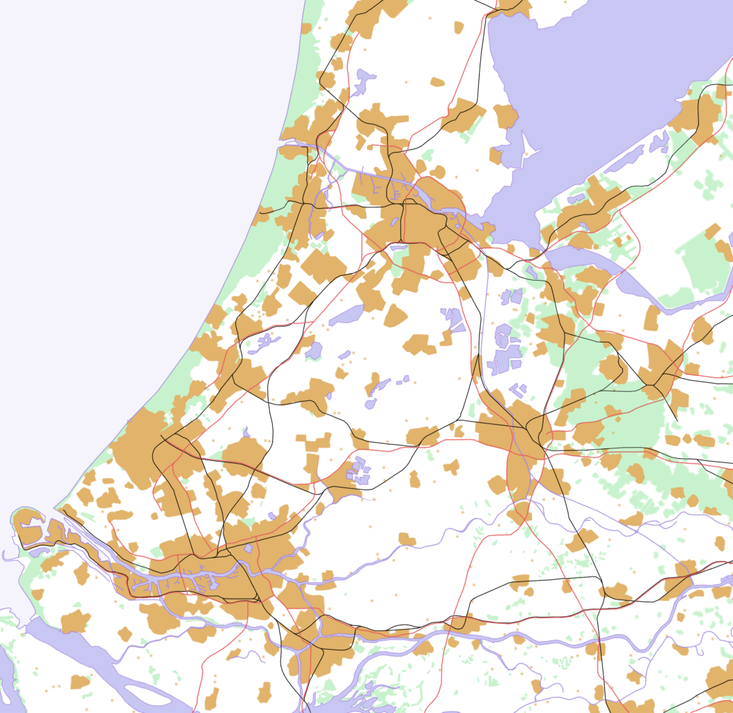
This is a schematic map of the Randstad, Netherlands.
A few notes:
- Orange: Urban areas (schematic) - the urban areas have been a bit overestimated to show the urban areas more clearly. Areas (like parks) in a city are part of the urban area. Some very small villages are not included. Residential areas, industrial and commercial areas are combined.
- Green: Forests and dunes (schematic)- nearby forests and dunes are combined.
- Light Blue: Sea (schematic)
- Middle Blue: Rivers and lakes (schematic) - smaller rivers, lakes and creeks are not included.
- Red: Highways
- Black: Railways
[edit] Licensing
I made this map all by myself in Krita. Last color adjustments where made in the Gimp.

Bestandsverwijzingen
Dit bestand wordt op de volgende pagina's gebruikt:

