Billede:Denmark 1921.jpg
Fra Wikipedia, den frie encyklopædi


Størrelse af vist billede: 425 × 600 pixel
Image in higher resolution (1533 × 2163 pixel, file size: 791 KB, MIME type: image/jpeg)
| Denne fil er fra Wikimedia Commons, en samling af åbent indhold som Wikimedia Foundation er vært for. Beskrivelsen fra siden med beskrivelse af billedet er vist nedenfor. |
[edit] Summary
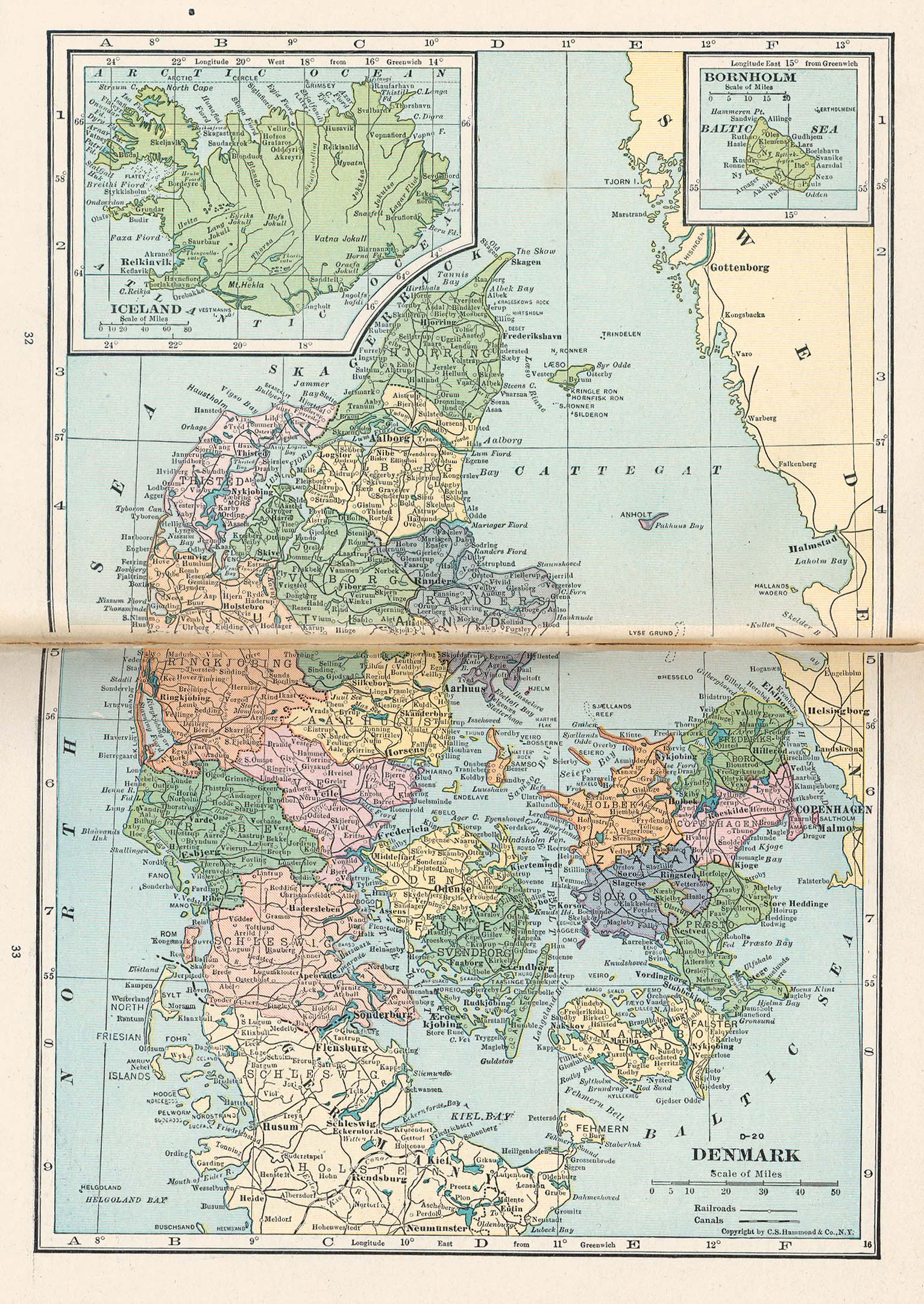
Da: Kort over Danmark, 1921. Scanning fra bog med streg midt i kortet fra bogryg.
En: Map of Denmark, 1921. Scan from book with a line through the map from the middle of the book.
From Putnam's Handy Volume Atlas of the World. Published by G.P. Putnam's Sons, New York and London, 1921.
"Courtesy of the University of Texas Libraries, The University of Texas at Austin."
URL: http://www.lib.utexas.edu/maps/historical/denmark_1921.jpg
[edit] Licensing
|
|
This image is in the public domain in the United States. In most cases, this means that its first publication was in the United States prior to January 1, 1923 or that its copyright expired in the United States. |
|
|
|
This image might not be in the public domain outside of the United States (this especially applies in Canada, China (not Macao or Taiwan), Germany or Switzerland). The creator and year of publication are essential information and must be provided. See Wikipedia:Public domain and Wikipedia:Copyrights for more details. |
Billedehenvisninger
De følgende sider henviser til dette billede:
Metadata
Denne fil indeholder ekstra information, som formentlig er tilføjet fra et digitalt kamera eller en skanner, der enten blev brugt til at skabe billede eller digitalisere det. Hvis filen har været ændret siden dens oprindelige tilblivelse, kan nogle detaljer muligvis ikke fuldt ud repræsentere det modificerede billede.
| Orientation | Normal |
|---|---|
| Horizontal resolution | 200 dpi |
| Vertical resolution | 200 dpi |
| Software used | Adobe Photoshop 7.0 |
| File change date and time | 30. jun 2003 kl. 14:53 |
| Color space | 65535 |

