Dosiero:EUROPE 1919-1929 POLITICAL 01.png
El Vikipedio

Grandeco de la antaŭmontro: 642 × 599 pikseloj
Bildo en pli alta difino (857 × 800 pixel, file size: 113 KB, MIME type: image/png)
| | Tiu dosiero elĉerpiĝas de la Vikimedia Komunejo, kolekto de libere uzeblaj bildoj. Vidu ĝian paĝon ĉe la Komunejo por permesinformo kaj historio de redaktado. |
[edit] Summary
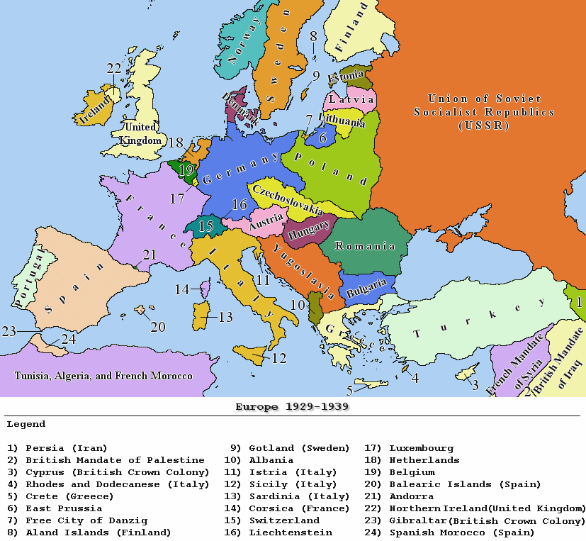
| Description |
Political map of Europe between the years 1929 and 1939 |
|---|---|
| Source |
own work |
| Date |
December 27, 2006 |
| Author |
Jan Humpolík |
| Permission |
GNU |
| Other versions | N/A |
[edit] Licensing

Ligiloj al la dosiero
La jenaj paĝoj ligas al ĉi tiu dosiero:

