

Imago:Map of Finland with provinces (numbered).png
E Vicipaedia
No higher resolution available.
Map_of_Finland_with_provinces_(numbered).png (150 × 260 pixel, file size: 2 chiliocteti, MIME type: image/png)
| | Hic est fasciculus ex Vicimediis Communibus. Vide eius descriptionem apud Communia ut plura discas. |
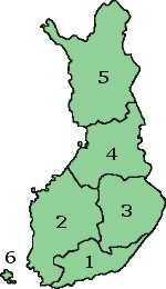
Map of Finland with the Province lines visible (numbered)
(c) adrian.benko, 2005, based on images by (c) helix84, 2005, based on images by (c) Jani Niemenmaa, 2003

Historia fasciculi
Ad emendationem fasciculi inspiciendum, preme in diem/tempus.
| Dies/Tempus | Usor | Dimensiones | Magnitudo fasciculi | Summarium | |
|---|---|---|---|---|---|
| recentissima | 15:37, 12 Octobris 2007 | Skies | 150×260 | 2 chiliocteti | Map of Finland with the Province lines visible (numbered) (c) adrian.benko, 2005, based on images by (c) helix84, 2005, based on images by (c) Jani Niemenmaa, 2003 {{GFDL}} [[Category:Locator m |
| 15:34, 12 Octobris 2007 | Skies | 150×260 | 2 chiliocteti | Map of Finland with the Province lines visible (numbered) (c) adrian.benko, 2005, based on images by (c) helix84, 2005, based on images by (c) Jani Niemenmaa, 2003 {{GFDL}} [[Category:Locator m | |
| 18:32, 27 Aprilis 2005 | Adrian.benko | 150×261 | 17 chiliocteti | Map of Finland with the Province lines visible (numbered) (c) User:adrian.benko, 2005, based on images by (c) helix84, 2005, based on images by (c) Jani Niemenmaa, 2003 {{GFDL}} |
Nexus
Paginae sequentes ad hunc fasciculum nectunt:


.png)
.png)