ภาพ:Europe map 220BC.PNG
จากวิกิพีเดีย สารานุกรมเสรี

Size of this preview: 628 × 599 pixel
ดูภาพที่มีความละเอียดสูงกว่า (1143 × 1091 pixel, file size: 41 KB, MIME type: image/png)
| | ไฟล์นี้มาจากวิกิมีเดียคอมมอนส์ ซึ่งรายละเอียดที่ปรากฏด้านล่างมาจากหน้าคำอธิบายของไฟล์นั้นๆ จากต้นฉบับในคอมมอนส์ |
[edit] Summary
| Description |
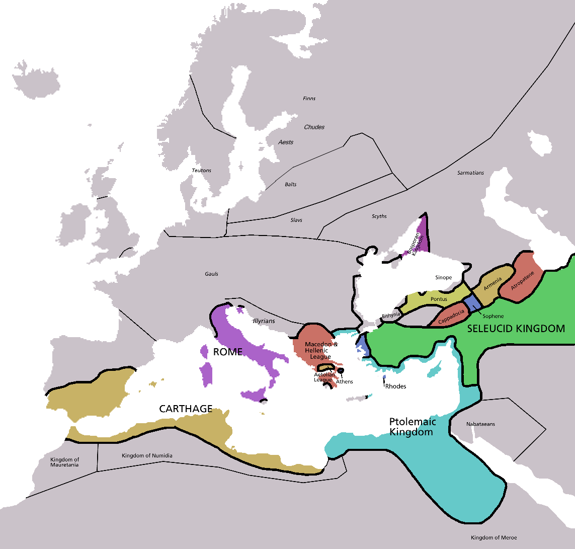
Map of Europe in 220BC, based on free map of europe Image:BlankMap-Europe.png. Many of the border lines are approximations. Information from Penguin atlas of ancient history. |
|---|---|
| Source | |
| Date |
12 January 2007 |
| Author | |
| Permission |
see below |
| Other versions | map without text, map in french |
 |
This map image should be recreated using vector graphics as an SVG file. This has several advantages; see Commons:Images for cleanup for more information. If an SVG form of this image is already available, please upload it. After uploading an SVG, replace this template with template {{SupersededSVG|new image name.svg}} in this image. |
|
Català | Česky | Dansk | Deutsch | English | Esperanto | Español | Français | Italiano | 日本語 | 한국어 | Nederlands | Polski | Português | Русский | العربية | 正體中文 | +/- |
|
| Maps of the history of Europe | |
| BC |
Middle Neolithic · Late Neolithic · 220 |
|
|
|
| AD |
60 · 395 · 400 · 450 · 526 · 526-600 · 800 · 814 · 843-870 · 998 · 1000 · 1092 · 1097 · 1142 · 1190 · 1328 · 1360 · C.15 · 1430 · 1470 · 1490 · 1550 · 1648 · 1708 · 1740 · 1812 · 1815 · 1890 · 1911 · 1914-24 · 1941-42 · 1942-45 · 1945-89 · 1993-2006 · 2006 to date |
| (this template: · view · discuss ) | |
[edit] Licensing

ลิงก์ภาพ
หน้าต่อไปนี้ โยงมาที่ภาพนี้:

