Image:Han map.jpg
维基百科,自由的百科全书

| Description |
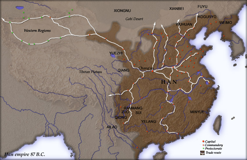
Map of en:Han Dynasty empire 87 BC, showing the capital en:Chang'an and the location of all en:commandery seats. In the Western Regions, a number of pretectorates were Han vassals and under the nominal authority of the Chief Protector of the Western Regions appointed by the Han court. The northern border is the line of the en:Qin Dynasty en:Great Wall. Trade routes are generally based on the work of en:Joseph Needham. Selected non-Chinese peoples are also shown. Created and copyright (2004) by Yuninjie. Released under the GNU FDL. |
|---|---|
| Source | |
| Date | |
| Author |
User Yuninjie on en.wikipedia |
| Permission |
Released under the GNU Free Documentation License. |
| Other versions |
Originally from en.wikipedia; description page is (was) here * 00:02, 6 November 2004 [[:en:User:Yuninjie|Yuninjie]] 850×550 (154,737 bytes) <span class="comment">(Map of Han empire 87 BC)</span> |

(Uploaded using CommonsHelper or PushForCommons)
图像链接
以下页面链接到本图像:
元数据
此文件中包含有扩展的信息。这些信息可能是由数码相机或扫描仪在创建或数字化过程中所添加。
如果此文件的源文件已经被修改,一些信息在修改后的文件中将不能完全反映出来。
| 定位 | 标准 |
|---|---|
| 水平解析度 | 150 dpi |
| 垂直解析度 | 150 dpi |
| 处理软件 | Adobe Photoshop 7.0 |
| 文件更改的日期与时间 | 11:03 2004年11月6日 |
| 颜色空间 | 65535 |

