画像:Mongol Empire map.gif
出典: フリー百科事典『ウィキペディア(Wikipedia)』

No higher resolution available.
Mongol_Empire_map.gif (752 × 591 pixel, file size: 162 キロバイト, MIME type: image/gif)
| このファイルはウィキメディア・コモンズから呼び出されたものです。 ページ・ノートへの記入や履歴などの詳細の確認はコモンズの画像説明ページ(ノート/履歴/ログ)を使用してください。 |
[編集]
 ウィキメディア・コモンズの記述
[edit] Summary
| Description |
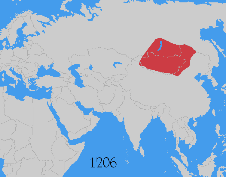
Map showing changes in borders of the Mongol Empire from founding by Genghis Khan in 1206, Genghis Khan's death in 1227 to the rule of Kublai Khan (1260–1294). (Uses modern day borders) ██ Mongol Empire By 1294 the empire had split into: ██ Golden Horde ██ Ilkhanate ██ Empire of the Great Khan (Yuan Dynasty) |
|---|---|
| Source |
Based on the freely licenced Image:Genghis khan empire at his death.png using information from maps of the Mongol Empire in atlases and on the web such as [1], [2], [3], [4], [5]. Made in Photoshop and Painter. |
| Date |
June 2006 |
| Author | |
| Permission |
self made |
| Other versions | other maps on commons - same animation but with alternative colours, greatest extent, Mongol dominions, 1294 |
[edit] Licensing

リンク
この画像にリンクしているページの一覧:


![[1]](http://www.silk-road.com/maps/images/mongol.jpg)
![[2]](http://www.loyno.edu/~seduffy/MapImages/MongolEmpire-display.jpg)
![[3]](http://www.siu.edu/~dfll/Chinese/mongol.jpg)
![[4]](http://www.allempires.com/empires/mongol/mongolempire_map.jpg)
![[5]](http://www.tiscali.co.uk/reference/encyclopaedia/hutchinson/images/c01786.jpg)